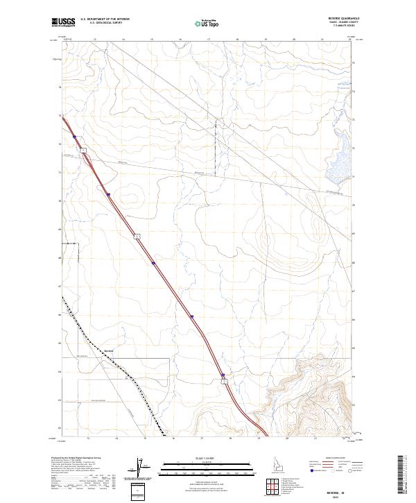
2023 Map of Reverse
USGS Topo · Published 2023About this map
Reverse stands as the primary settlement in this corner of Elmore County, situated along the diagonal path of the modern interstate and the historic rail corridor. The landscape is defined by its agricultural and transit heritage, evidenced by the convergence of local infrastructure like Beet Dump Rd and Billy Rio Loop Rd. Transportation history is layered across the terrain, where Old Hwy 30 and Bennett Rd parallel the newer thoroughfares, tracing the evolution of movement through the Idaho desert. To the northeast, the Hot Springs Cr Reservoir captures the flow of Hot Springs Creek, a vital water resource in an otherwise arid expanse. The southern portion of the sheet is marked by the seasonal drainage of Dry Creek and a network of township boundaries including t4s r7e and t5s r8e, reflecting the structured land management of the region.
Find a feature on this map
15 named features on this map. Tap any name to fly to it.
Don’t see what you’re looking for? This feature index may not catch every label — zoom into the map to look around manually.
Map Details
Editions of this 2023 Reverse Map
This is the sole edition of this map. No revisions or reprints were ever made.
Other maps of this area

1892 · Mountain Home
USGS Topo · 1:125,000

1892 · Camas Prairie
USGS Topo · 1:125,000

1893 · Mountain Home
USGS Topo · 1:125,000

1893 · Camas Prairie
USGS Topo · 1:125,000

1947 · Indian Cove
USGS Topo · 1:24,000

1947 · Hammett
USGS Topo · 1:24,000

1947 · Sand Dunes
USGS Topo · 1:24,000

1948 · Sand Dunes
USGS Topo · 1:24,000

1948 · Hammett
USGS Topo · 1:24,000

1948 · Indian Cove
USGS Topo · 1:24,000