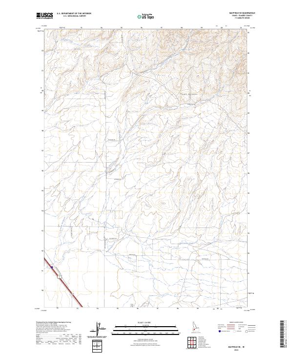
2024 Map of Mayfield SE
USGS Topo · Published 2024About this map
The Danskin Mountains dominate the high ground of Elmore County in this contemporary survey, where drainage systems like Soles Rest Creek and Dry Creek carve through the Idaho landscape. The map reveals a transition from the elevated peaks in the north to the flatter township and range divisions of the south, marked by a systematic grid of rural access routes. Local connectivity is defined by named thoroughfares such as Slater Flat Rd and Base Line Rd, alongside family-named or descriptive lanes like E Rumsey Ln and W Wayno Rd. In the southwestern corner, the terrain gives way to the arterial Desert Wind Rd, reflecting modern transport patterns that skirt the more complex topography found near Mud Springs Creek. This document serves as a clear record of current land management, displaying the precise intersection of natural watercourses and the established roadway network.
Find a feature on this map
23 named features on this map. Tap any name to fly to it.
Don’t see what you’re looking for? This feature index may not catch every label — zoom into the map to look around manually.
Map Details
Editions of this 2024 Mayfield SE Map
This is the sole edition of this map. No revisions or reprints were ever made.
Other maps of this area

1892 · Mountain Home
USGS Topo · 1:125,000

1893 · Mountain Home
USGS Topo · 1:125,000

1955 · Hailey
USGS Topo · 1:250,000
1956 · Cinder Cone Butte
USGS Topo · 1:24,000

1956 · Crater Rings
USGS Topo · 1:24,000

1956 · Mountain Home North
USGS Topo · 1:24,000

1956 · Mountain Home
USGS Topo · 1:62,500

1959 · Hailey
USGS Topo · 1:250,000

1960 · Mayfield
USGS Topo · 1:62,500

1960 · Danskin Peak
USGS Topo · 1:62,500