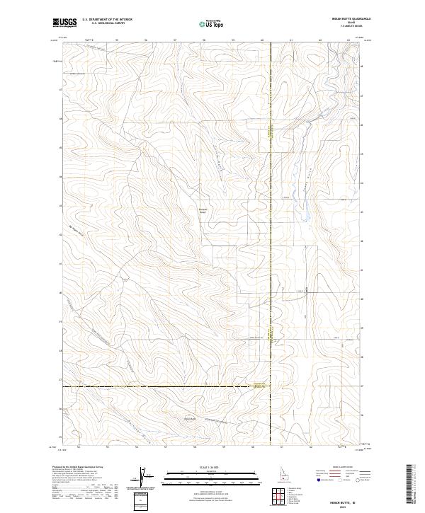
2023 Map of Indian Butte
USGS Topo · Published 2023About this map
The Old Oregon Trail Hwy cuts across the northern reaches of this high desert landscape, marking a historic corridor of western migration that remains visible in the modern road network. This arid region of Elmore County, dominated by the Bruneau Desert, is defined by deep drainage patterns such as Cassia Gulch and Tuana Gulch that flow toward the Snake River valley. The infrastructure reflects a landscape of large-scale agriculture and transit, where the Cassia Canal provides essential water and a grid of rural routes like Glenns Ferry Castleford Rd and S Bell Rapids Rd connect isolated outposts. To the south, the prominent landmark of Indian Butte rises near the junction of Elmore and Owyhee counties, overlooking the rugged terrain of Rosevear Gulch.
Find a feature on this map
24 named features on this map. Tap any name to fly to it.
Don’t see what you’re looking for? This feature index may not catch every label — zoom into the map to look around manually.
Map Details
Editions of this 2023 Indian Butte Map
This is the sole edition of this map. No revisions or reprints were ever made.
Other maps of this area

1947 · Pasadena Valley
USGS Topo · 1:24,000

1948 · Pasadena Valley
USGS Topo · 1:24,000

1948 · Twentymile Butte
USGS Topo · 1:24,000

1948 · Ticeska
USGS Topo · 1:24,000

1949 · Ticeska
USGS Topo · 1:24,000

1949 · Pasadena Valley
USGS Topo · 1:62,500

1949 · Bliss
USGS Topo · 1:24,000

1949 · Hagerman
USGS Topo · 1:24,000

1949 · Indian Butte
USGS Topo · 1:24,000

1950 · Hagerman
USGS Topo · 1:24,000