
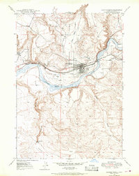
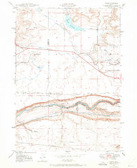
1949 Map of Pasadena Valley
USGS Topo · Published 1952About this map
Snake River canyon walls and high plateau terrain define this Idaho landscape, where the Oregon Trail once wound through the southern gulches. By the mid-20th century, the irrigation network of the King Hill Ditch and Main Canal had transformed the flatlands, supporting the rural community at Pasadena Valley. Local life centered around the Pasadena Valley School, while the Oregon Short Line and Union Pacific railroad tracks followed the river's northern bank near Ticeska.
Find a feature on this map
42 named features on this map. Tap any name to fly to it.
Don’t see what you’re looking for? This feature index may not catch every label — zoom into the map to look around manually.
Map Details
Editions of this 1949 Pasadena Valley Map
This is the sole edition of this map. No revisions or reprints were ever made.
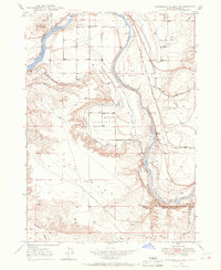
Other maps of this area

1892 · Camas Prairie
USGS Topo · 1:125,000

1893 · Camas Prairie
USGS Topo · 1:125,000
1947 · Glenns Ferry
USGS Topo · 1:24,000
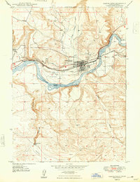
1947 · Pasadena Valley
USGS Topo · 1:24,000

1948 · Pasadena Valley
USGS Topo · 1:24,000
1948 · Glenns Ferry
USGS Topo · 1:24,000

1948 · Twentymile Butte
USGS Topo · 1:24,000
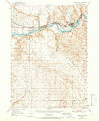
1948 · Glenns Ferry
USGS Topo · 1:62,500
1948 · Ticeska
USGS Topo · 1:24,000

1948 · Grindstone Butte
USGS Topo · 1:24,000