
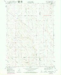
1949 Map of Indian Butte
USGS Topo · Published 1976About this map
Aerial Gunnery Range dominates this late-1940s landscape, reflecting the military's significant footprint in the high desert of Southern Idaho. Situated at the tri-county junction of Elmore, Owyhee, and Twin Falls counties, the terrain is defined by a series of deep drainage systems including Tuana Gulch, Cassia Gulch, and Big Pilgrim Gulch. The most prominent landmark, Indian Butte, rises above the surrounding plateaus near the southern edge of the survey area.
Find a feature on this map
17 named features on this map. Tap any name to fly to it.
Don’t see what you’re looking for? This feature index may not catch every label — zoom into the map to look around manually.
Map Details
Editions of this 1949 Indian Butte Map
2 editions found
Other maps of this area

1947 · Pasadena Valley
USGS Topo · 1:24,000

1948 · Pasadena Valley
USGS Topo · 1:24,000

1948 · Twentymile Butte
USGS Topo · 1:24,000

1948 · Ticeska
USGS Topo · 1:24,000

1949 · Ticeska
USGS Topo · 1:24,000

1949 · Pasadena Valley
USGS Topo · 1:62,500

1949 · Bliss
USGS Topo · 1:24,000

1949 · Hagerman
USGS Topo · 1:24,000

1950 · Hagerman
USGS Topo · 1:24,000

1950 · Bliss
USGS Topo · 1:24,000