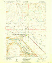
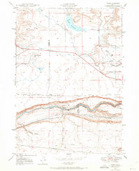
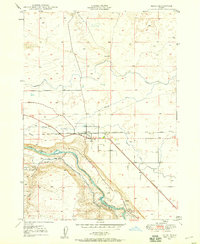
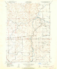
1950 Map of Bliss
USGS Topo · Published 1950About this map
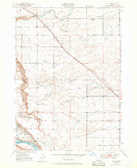
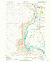
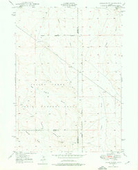
Bliss serves as the central hub of this 1950 survey, situated at a critical junction where the Union Pacific (Oregon Short Line) meets the high desert plateau. The landscape is defined by the dramatic drop from the plains into the canyon of the Snake River, where the Bliss Reservoir and the Main Canal indicate the scale of mid-century water management. This period shows a transition from traditional transit to expanded irrigation, with numerous unnamed irrigation ditches carving through the terrain. To the south, the King Shoestring road winds along the canyon rim, while local landmarks like Bliss Point and Tuana Gulch provide geographic context for the surrounding cattle country. A small Cem west of the town center offers a specific point of interest for genealogists tracing early families in Gooding County.
Find a feature on this map
14 named features on this map. Tap any name to fly to it.
Don’t see what you’re looking for? This feature index may not catch every label — zoom into the map to look around manually.
Map Details
Editions of this 1950 Bliss Map
This is the sole edition of this map. No revisions or reprints were ever made.
Other maps of this area

1892 · Camas Prairie
USGS Topo · 1:125,000

1893 · Camas Prairie
USGS Topo · 1:125,000
1948 · Ticeska
USGS Topo · 1:24,000

1949 · Ticeska
USGS Topo · 1:24,000

1949 · Pasadena Valley
USGS Topo · 1:62,500
1949 · Bliss
USGS Topo · 1:24,000
1949 · Gooding Butte
USGS Topo · 1:24,000
1949 · Tuttle
USGS Topo · 1:24,000
1949 · Hagerman
USGS Topo · 1:24,000
1949 · Indian Butte
USGS Topo · 1:24,000