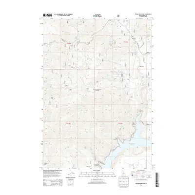
2013 Map of House Mountain
USGS Topo · Published 2013About this map
Boise National Forest dominates this high-altitude landscape of central Idaho, where the southern reaches of the mountain range meet the rising waters of the Anderson Ranch Reservoir. The terrain is defined by the prominent peaks of House Mtn and Granite Mtn, overlooking a network of steep drainages including Castle Cr, Fall Cr, and Evans Cr. This early 21st-century survey illustrates a region heavily focused on outdoor recreation and forest management, marked by numerous sites such as Ice Springs Campground and Castle Rock Campground. Along the reservoir's edge, Fall Creek Lodge serves as a remote landmark, while the southern margin of the sheet transitions into the more level ground of Little Camas Prairie and Wilson Flat. The map provides a clear picture of the Forest Service road network, including Sloan Gulch RD and Lake Creek RD, which provide access to these remote reaches of Elmore County.
Find a feature on this map
41 named features on this map. Tap any name to fly to it.
Don’t see what you’re looking for? This feature index may not catch every label — zoom into the map to look around manually.
Map Details
Editions of this 2013 House Mountain Map
This is the sole edition of this map. No revisions or reprints were ever made.
Other maps of this area

1892 · Mountain Home
USGS Topo · 1:125,000

1892 · Camas Prairie
USGS Topo · 1:125,000

1893 · Mountain Home
USGS Topo · 1:125,000

1893 · Camas Prairie
USGS Topo · 1:125,000

1894 · Idaho Basin
USGS Topo · 1:125,000

1894 · Rocky Bar
USGS Topo · 1:125,000

1955 · Hailey
USGS Topo · 1:250,000

1959 · Hailey
USGS Topo · 1:250,000

1960 · Danskin Peak
USGS Topo · 1:62,500

1962 · Hailey
USGS Topo · 1:250,000