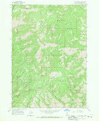
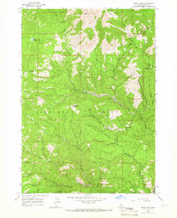
1964 Map of Cayuse Point
USGS Topo · Published 1970About this map
Bonaparte Mine and the Marsh Creek Mine stand as indicators of mid-century industrial interest in this corner of Elmore County. The landscape is defined by the convergence of the Boise National Forest and Sawtooth National Forest, where the Middle Fork Yuba River, South Fork Yuba River, and East Fork Yuba River navigate through complex terrain. Higher elevations are marked by Bald Mountain and the prominent Pony Ridge, which divides numerous drainages including Cayuse Creek and Democrat Creek. Primitive access is limited to a network of PACK TRAILs and JEEP TRAILs that cross the National Forest Boundary, reaching locations like the Hot Spring on the southeastern edge and the isolated Corbus Lake to the north.
Find a feature on this map
35 named features on this map. Tap any name to fly to it.
Don’t see what you’re looking for? This feature index may not catch every label — zoom into the map to look around manually.
Map Details
Editions of this 1964 Cayuse Point Map
2 editions found
Other maps of this area

1894 · Rocky Bar
USGS Topo · 1:125,000

1955 · Hailey
USGS Topo · 1:250,000

1959 · Hailey
USGS Topo · 1:250,000

1962 · Hailey
USGS Topo · 1:250,000
1964 · Featherville
USGS Topo · 1:24,000

1964 · Ross Peak
USGS Topo · 1:24,000

1964 · Cayuse Point
USGS Topo · 1:24,000
1964 · Jumbo Mtn
USGS Topo · 1:24,000
1964 · Grouse Butte
USGS Topo · 1:24,000
1964 · Rocky Bar
USGS Topo · 1:24,000