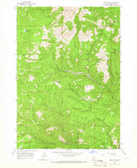
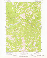
1964 Map of Rocky Bar
USGS Topo · Published 1966About this map
Rocky Bar sits at the heart of this rugged mining district in the Boise National Forest during the mid-1960s. The landscape is defined by the steep drainages of Bear Creek and the Feather River, which historically drew prospectors to the high mountain gulches. Traces of this mining history are evident at the Spanish Town (Site), while the administrative and recreational life of the era is marked by the Rocky Bar Guard Station and Elk Spring Campground. The terrain rises sharply toward Steel Mountain and Horse Ranch Mountain, with numerous narrow waterways like Red Warrior Creek and Lincoln Creek cutting through the forest. The presence of a Pack Trail winding through the Western Elmore County backcountry suggests a period when accessibility was still limited to primitive routes and light-duty roads, preserving the remote character of the Sawtooth National Forest boundary.
Find a feature on this map
35 named features on this map. Tap any name to fly to it.
Don’t see what you’re looking for? This feature index may not catch every label — zoom into the map to look around manually.
Map Details
Editions of this 1964 Rocky Bar Map
This is the sole edition of this map. No revisions or reprints were ever made.
Other maps of this area

1894 · Rocky Bar
USGS Topo · 1:125,000

1955 · Hailey
USGS Topo · 1:250,000

1959 · Hailey
USGS Topo · 1:250,000

1962 · Hailey
USGS Topo · 1:250,000
1964 · Featherville
USGS Topo · 1:24,000
1964 · Trinity Mtn
USGS Topo · 1:24,000

1964 · Little Trinity Lake
USGS Topo · 1:24,000

1964 · Cayuse Point
USGS Topo · 1:24,000
1964 · Grouse Butte
USGS Topo · 1:24,000
1972 · Phifer Creek
USGS Topo · 1:24,000