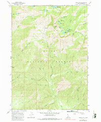
1964 Map of Trinity Mtn
USGS Topo · Published 1986About this map
Trinity Mtn Lookout 9451 stands as the dominant peak in this high-elevation region of the Boise National Forest during the mid-1960s. The landscape is defined by a dense concentration of alpine waters, including Big Trinity Lake, Green Island Lake, and the series of Rainbow Lakes such as Middle Rainbow Lake and Little Rainbow Lake. A network of established paths, including several marked simply as Pack Trail, suggests a terrain that was primarily accessed by horse or on foot, connecting remote sites like Fiddle Lake and Heart Lake.
Find a feature on this map
44 named features on this map. Tap any name to fly to it.
Don’t see what you’re looking for? This feature index may not catch every label — zoom into the map to look around manually.
Map Details
Editions of this 1964 Trinity Mtn Map
3 editions found
Other maps of this area

1892 · Mountain Home
USGS Topo · 1:125,000

1892 · Camas Prairie
USGS Topo · 1:125,000

1893 · Mountain Home
USGS Topo · 1:125,000

1893 · Camas Prairie
USGS Topo · 1:125,000

1894 · Idaho Basin
USGS Topo · 1:125,000

1894 · Rocky Bar
USGS Topo · 1:125,000

1955 · Hailey
USGS Topo · 1:250,000

1959 · Hailey
USGS Topo · 1:250,000

1960 · Danskin Peak
USGS Topo · 1:62,500

1962 · Hailey
USGS Topo · 1:250,000