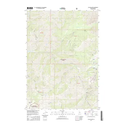
2017 Map of Atlanta West
USGS Topo · Published 2017About this map
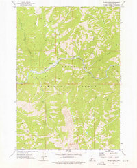
Atlanta and its surrounding mining-district landscape are the focus of this 2017 survey, where the Middle Fork Boise River cuts through the high country of the Boise National Forest and Sawtooth National Forest. The map documents a geography defined by its extractive history and remote access, with Quartz Gulch and Big Gulch flanking the townsite while the Atlanta Airport provides a critical link to this mountain interior. The drainage network is complex, featuring the Yuba River and Little Queens River, alongside various spurs like China Basin Spur E that reach into the drainages of China Basin. To the southwest, the terrain rises toward James Creek Summit, while Black Warrior and Hot Creek indicate the varied natural features of the Elmore County backcountry. This contemporary update tracks the established forest road network, including the primary Atlanta Road and high-elevation routes like Snowline, detailing how this historic mining hub integrates with its protected wilderness surroundings.
Find a feature on this map
60 named features on this map. Tap any name to fly to it.
Don’t see what you’re looking for? This feature index may not catch every label — zoom into the map to look around manually.
Map Details
Editions of this 2017 Atlanta West Map
This is the sole edition of this map. No revisions or reprints were ever made.
Other maps of this area

1894 · Rocky Bar
USGS Topo · 1:125,000

1955 · Hailey
USGS Topo · 1:250,000

1959 · Hailey
USGS Topo · 1:250,000

1962 · Hailey
USGS Topo · 1:250,000

1964 · Ross Peak
USGS Topo · 1:24,000

1964 · Cayuse Point
USGS Topo · 1:24,000
1964 · Rocky Bar
USGS Topo · 1:24,000
1972 · Atlanta East
USGS Topo · 1:24,000
1972 · Swanholm Peak
USGS Topo · 1:24,000
1972 · Phifer Creek
USGS Topo · 1:24,000