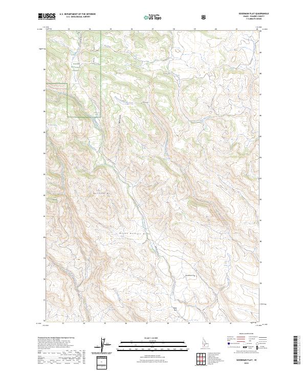
2023 Map of Goodman Flat
USGS Topo · Published 2023About this map
Allan's Corral and the nearby Allan's Cutoff highlight the historical ranching and transit patterns in this section of Elmore County. Located within the Boise National Forest, the landscape is defined by the significant rise of Bennett Mtn and the broader Mount Bennett Hills. This terrain is characterized by a complex network of drainage systems, including Little Camas Creek, West Fork King Hill Creek, and Alkali Creek, which have carved numerous gulches such as Bear Gulch and Burns Gulch into the volcanic slopes.
Find a feature on this map
33 named features on this map. Tap any name to fly to it.
Don’t see what you’re looking for? This feature index may not catch every label — zoom into the map to look around manually.
Map Details
Editions of this 2023 Goodman Flat Map
This is the sole edition of this map. No revisions or reprints were ever made.
Other maps of this area

1892 · Camas Prairie
USGS Topo · 1:125,000

1893 · Camas Prairie
USGS Topo · 1:125,000

1955 · Hailey
USGS Topo · 1:250,000
1958 · Bennett Mtn
USGS Topo · 1:62,500

1958 · King Hill
USGS Topo · 1:62,500

1959 · Hailey
USGS Topo · 1:250,000

1962 · Hailey
USGS Topo · 1:250,000

1963 · High Prairie
USGS Topo · 1:24,000
1973 · Anderson Ranch Dam
USGS Topo · 1:24,000
1973 · Cat Creek Summit
USGS Topo · 1:24,000