
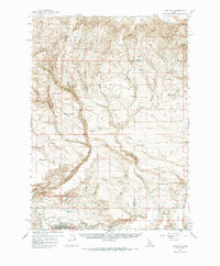
1958 Map of King Hill
USGS Topo · Published 1960About this map
The King Hill settlement and the Union Pacific railroad corridor define the southern edge of this Idaho survey, where the river valley gives way to the high, arid terrain of the Mount Bennett Hills. This landscape is marked by a complex network of water management features, including a Ditch, a siphon, and a fume, illustrating the mid-century effort to divert water for local agriculture and livestock. Cultural and natural landmarks are scattered across the high desert, from the curiously named Devils Playground and Indian Writing Water Hole to the Cem located near the townsite.
Find a feature on this map
56 named features on this map. Tap any name to fly to it.
Don’t see what you’re looking for? This feature index may not catch every label — zoom into the map to look around manually.
Map Details
Editions of this 1958 King Hill Map
2 editions found
Other maps of this area

1892 · Camas Prairie
USGS Topo · 1:125,000

1893 · Camas Prairie
USGS Topo · 1:125,000

1947 · Glenns Ferry
USGS Topo · 1:24,000

1947 · Pasadena Valley
USGS Topo · 1:24,000

1948 · Pasadena Valley
USGS Topo · 1:24,000

1948 · Glenns Ferry
USGS Topo · 1:24,000

1948 · Glenns Ferry
USGS Topo · 1:62,500

1948 · Ticeska
USGS Topo · 1:24,000

1949 · Ticeska
USGS Topo · 1:24,000

1949 · Pasadena Valley
USGS Topo · 1:62,500