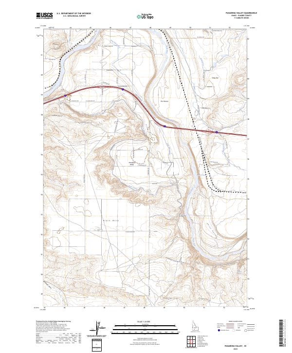
2023 Map of Pasadena Valley
USGS Topo · Published 2023About this map
The Snake River carves a winding path through the basalt and sagebrush landscape of Elmore County, defining the agricultural and topographical character of this southern Idaho region. Irrigation infrastructure is central to the area's development, evidenced by the sophisticated network of the Basin Lateral, King Hill Lateral, and the Y Canal that feed the surrounding flats and valleys. The settlement of Pasadena Valley sits within this irrigated corridor, supported by a grid of rural roads such as S Carnahan Rd and Frog Hollow Rd.
Find a feature on this map
63 named features on this map. Tap any name to fly to it.
Don’t see what you’re looking for? This feature index may not catch every label — zoom into the map to look around manually.
Map Details
Editions of this 2023 Pasadena Valley Map
This is the sole edition of this map. No revisions or reprints were ever made.
Other maps of this area

1892 · Camas Prairie
USGS Topo · 1:125,000

1893 · Camas Prairie
USGS Topo · 1:125,000

1947 · Glenns Ferry
USGS Topo · 1:24,000

1947 · Pasadena Valley
USGS Topo · 1:24,000

1948 · Pasadena Valley
USGS Topo · 1:24,000

1948 · Glenns Ferry
USGS Topo · 1:24,000

1948 · Twentymile Butte
USGS Topo · 1:24,000

1948 · Glenns Ferry
USGS Topo · 1:62,500

1948 · Ticeska
USGS Topo · 1:24,000

1948 · Grindstone Butte
USGS Topo · 1:24,000