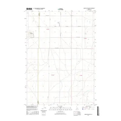
2017 Map of Cinder Cone Butte
USGS Topo · Published 2017About this map
Cinder Cone Butte rises as a prominent volcanic landmark on the high desert landscape between Ada and Elmore Counties. This 2017 survey shows a region defined by geometric land partitions and a sparse network of roads, including Simco Rd and N Cinder Butte Rd, which navigate the arid terrain. The map captures a primarily agricultural and open-range environment, evidenced by the P and R Field and various section lines that delineate property and usage in this part of southern Idaho. Drainage patterns are clearly marked by the ephemeral paths of Squaw Cr and Canyon Cr, which cut through the sagebrush-covered plains toward the Snake River plain. The inclusion of specialized access routes like S Cinder Butte Summit Rd underscores the topographical significance of the butte itself for local navigation and land management.
Find a feature on this map
14 named features on this map. Tap any name to fly to it.
Don’t see what you’re looking for? This feature index may not catch every label — zoom into the map to look around manually.
Map Details
Editions of this 2017 Cinder Cone Butte Map
This is the sole edition of this map. No revisions or reprints were ever made.
Other maps of this area

1892 · Mountain Home
USGS Topo · 1:125,000

1892 · Bisuka
USGS Topo · 1:125,000

1893 · Mountain Home
USGS Topo · 1:125,000

1894 · Bisuka
USGS Topo · 1:125,000

1947 · Dorsey Butte
USGS Topo · 1:24,000

1948 · Dorsey Butte
USGS Topo · 1:24,000

1948 · Big Foot Butte
USGS Topo · 1:62,500

1948 · Little Joe Butte
USGS Topo · 1:24,000

1949 · Little Joe Butte
USGS Topo · 1:24,000

1955 · Orchard
USGS Topo · 1:24,000