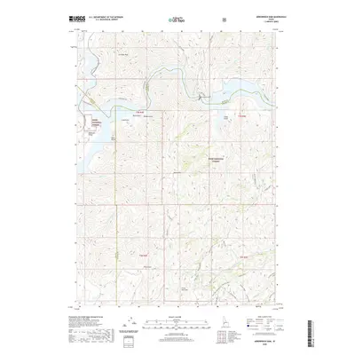
2020 Map of Arrowrock Dam
USGS Topo · Published 2020About this map
Arrowrock Dam anchors this landscape where the Boise River system transitions through the Boise National Forest. The map shows a complex network of canyons and high ridges, including Cervidae Peak and Kepros Mtn, overlooking the meeting of Arrowrock Reservoir and the eastern reach of Lucky Peak Lake. Local transit relies on the historic Atlanta Road and the Ponderosa Pine Scenic Route, while the interior is marked by numerous named gulches like Long Gulch and Sams Gulch.
Find a feature on this map
59 named features on this map. Tap any name to fly to it.
Don’t see what you’re looking for? This feature index may not catch every label — zoom into the map to look around manually.
Map Details
Editions of this 2020 Arrowrock Dam Map
This is the sole edition of this map. No revisions or reprints were ever made.
Other maps of this area

1892 · Mountain Home
USGS Topo · 1:125,000

1892 · Boise
USGS Topo · 1:125,000

1892 · Bisuka
USGS Topo · 1:125,000

1893 · Mountain Home
USGS Topo · 1:125,000

1894 · Bisuka
USGS Topo · 1:125,000

1894 · Idaho Basin
USGS Topo · 1:125,000

1897 · Boise
USGS Topo · 1:125,000

1949 · Robie Creek
USGS Topo · 1:24,000

1954 · Boise
USGS Topo · 1:62,500

1955 · Hailey
USGS Topo · 1:250,000