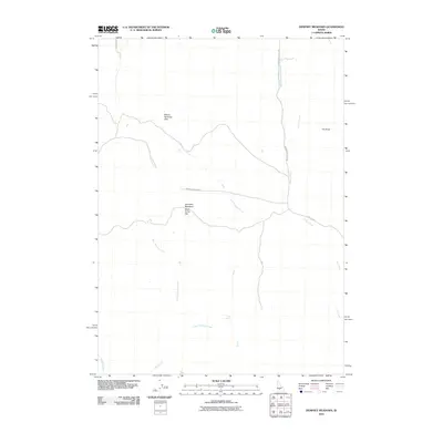
2010 Map of Dempsey Meadows
USGS Topo · Published 2010About this map
Dempsey Meadows and the surrounding high country of the Mount Bennnett Hills define this corner of Elmore County. The landscape is shaped by a complex network of drainage systems, including East Dempsey Creek and West Dempsey Creek, which flow through the open expanse of Dead Horse Flat. Significant elevation markers such as The Knob provide orientation in this primarily rural terrain, where water sources like Tub Spring and Clover Creek would have been vital for local grazing and land use. The road network, including the Hill City Rd and Dempsey Meadow Rd, reflects the area's role in connecting high-plateau meadows with larger regional transport corridors. This survey provides a clear view of the hydrological and topographic character of the Idaho backcountry just before the turn of the decade.
Find a feature on this map
16 named features on this map. Tap any name to fly to it.
Don’t see what you’re looking for? This feature index may not catch every label — zoom into the map to look around manually.
Map Details
Editions of this 2010 Dempsey Meadows Map
This is the sole edition of this map. No revisions or reprints were ever made.
Other maps of this area

1892 · Camas Prairie
USGS Topo · 1:125,000

1893 · Camas Prairie
USGS Topo · 1:125,000

1955 · Hailey
USGS Topo · 1:250,000

1957 · Fairfield
USGS Topo · 1:62,500

1957 · Davis Mountain
USGS Topo · 1:62,500

1958 · King Hill
USGS Topo · 1:62,500

1959 · Hailey
USGS Topo · 1:250,000

1962 · Hailey
USGS Topo · 1:250,000

1963 · High Prairie
USGS Topo · 1:24,000

1963 · Hill City
USGS Topo · 1:24,000