
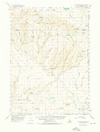
1957 Map of Davis Mountain
USGS Topo · Published 1959About this map
The Bennett Hills dominate this high-desert landscape on the border of Camas and Gooding counties, where complex drainages like Clover Creek and Coyote Creek carve through the volcanic plateau. In the late 1950s, this area remained a sparsely populated rangeland characterized by remote outposts and seasonal camps. Evidence of early migration and settlement is found at the Emigrant Cemetery near Hot Sulphur Lake, while the geological complexity of the region is highlighted by the City of Rocks and the presence of the Chalk Mine along the Main Ditch.
Find a feature on this map
57 named features on this map. Tap any name to fly to it.
Don’t see what you’re looking for? This feature index may not catch every label — zoom into the map to look around manually.
Map Details
Editions of this 1957 Davis Mountain Map
2 editions found
Other maps of this area

1892 · Camas Prairie
USGS Topo · 1:125,000

1893 · Camas Prairie
USGS Topo · 1:125,000

1948 · Ticeska
USGS Topo · 1:24,000

1949 · Ticeska
USGS Topo · 1:24,000

1949 · Pasadena Valley
USGS Topo · 1:62,500

1949 · Bliss
USGS Topo · 1:24,000

1949 · Gooding Butte
USGS Topo · 1:24,000

1950 · Gooding Butte
USGS Topo · 1:24,000

1950 · Bliss
USGS Topo · 1:24,000

1955 · Twin Falls
USGS Topo · 1:250,000