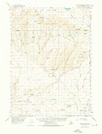
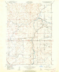
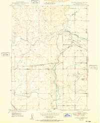
1957 Map of Davis Mountain
USGS Topo · Published 1976About this map
The high desert and mountain slopes of the Bennett Hills dominate this mid-century survey of the Camas and Gooding County line. Early Idaho travel and settlement patterns are evident at the Emigrant Cemetery and isolated homesteads like Hole-in-the-Wall Cabin and the Crist Cabin. The landscape is a complex network of seasonal drainages and springs, including Hot Spring and Hot Sulphur Lake, which supported ranching operations at Bray Lake Ranch and Fir Grove Ranch. Resource extraction and water management are visible through the Chalk Mine and the Main Ditch Canal feeding the southern plains. Notable geological features like the City of Rocks and Dead Horse Cave mark the transition from the high Camas Prairie in the north toward the volcanic terrain of the Snake River Plain further south.
Find a feature on this map
61 named features on this map. Tap any name to fly to it.
Don’t see what you’re looking for? This feature index may not catch every label — zoom into the map to look around manually.
Map Details
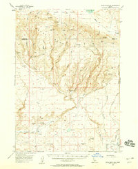
Editions of this 1957 Davis Mountain Map
2 editions found
Other maps of this area

1892 · Camas Prairie
USGS Topo · 1:125,000

1893 · Camas Prairie
USGS Topo · 1:125,000
1948 · Ticeska
USGS Topo · 1:24,000

1949 · Ticeska
USGS Topo · 1:24,000

1949 · Pasadena Valley
USGS Topo · 1:62,500
1949 · Bliss
USGS Topo · 1:24,000
1949 · Gooding Butte
USGS Topo · 1:24,000
1950 · Gooding Butte
USGS Topo · 1:24,000
1950 · Bliss
USGS Topo · 1:24,000

1955 · Twin Falls
USGS Topo · 1:250,000