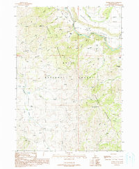
1990 Map of Danskin Peak
USGS Topo · Published 1991About this map
The South Fork Boise River winds through the heart of this high-elevation landscape, where numerous rapids and steep gulches like Raspberry Gulch and Long Gulch drop toward the canyon floor. Published in the early 1990s from data collected in the preceding decades, the map documents the transition from the river basin to the high Danskin Mountains. Elevated terrain features such as Smith Prairie and the Lower Bench overlook the river, while the namesake Danskin Peak stands as a prominent landmark within the Boise National Forest. A network of water sources, including Danskin Lake and Mud Spring, supports the area's natural drainage. The presence of the Danskin Trail and various named flats like Little Fiddler Flat and Cougar Flat illustrates the historical use of these ridges for transit and grazing before more modern development reached this part of Elmore County.
Find a feature on this map
41 named features on this map. Tap any name to fly to it.
Don’t see what you’re looking for? This feature index may not catch every label — zoom into the map to look around manually.
Map Details
Editions of this 1990 Danskin Peak Map
This is the sole edition of this map. No revisions or reprints were ever made.
Other maps of this area

1892 · Mountain Home
USGS Topo · 1:125,000

1893 · Mountain Home
USGS Topo · 1:125,000

1894 · Idaho Basin
USGS Topo · 1:125,000

1955 · Hailey
USGS Topo · 1:250,000

1959 · Hailey
USGS Topo · 1:250,000

1960 · Mayfield
USGS Topo · 1:62,500

1960 · Danskin Peak
USGS Topo · 1:62,500

1962 · Hailey
USGS Topo · 1:250,000
1964 · Prairie
USGS Topo · 1:24,000
1964 · Long Gulch
USGS Topo · 1:24,000