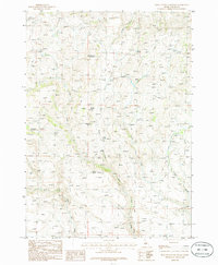
1986 Map of Deer Heaven Mountain
USGS Topo · Published 1986About this map
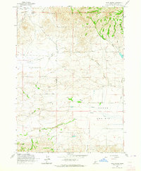
Deer Heaven Mountain dominates this high-altitude corner of Idaho-Elmore County, where a network of ephemeral water sources and rugged drainage systems define the landscape. This mid-1980s provisional study documents a region shaped by resource exploration and natural hydrology, evidenced by several prospect locations and a series of distinctively named water points. The map reveals a reliance on isolated springs such as Whiskey Spring, Blackhawk Spring, and Bourbon Spring, which likely served as vital landmarks for those traversing the area.
Find a feature on this map
17 named features on this map. Tap any name to fly to it.
Don’t see what you’re looking for? This feature index may not catch every label — zoom into the map to look around manually.
Map Details
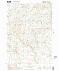
Editions of this 1986 Deer Heaven Mountain Map
2 editions found
Other maps of this area

1892 · Camas Prairie
USGS Topo · 1:125,000

1893 · Camas Prairie
USGS Topo · 1:125,000

1955 · Hailey
USGS Topo · 1:250,000
1958 · Bennett Mtn
USGS Topo · 1:62,500
1958 · King Hill
USGS Topo · 1:62,500

1959 · Hailey
USGS Topo · 1:250,000

1962 · Hailey
USGS Topo · 1:250,000
1963 · High Prairie
USGS Topo · 1:24,000
1963 · Hill City
USGS Topo · 1:24,000
1973 · Cat Creek Summit
USGS Topo · 1:24,000