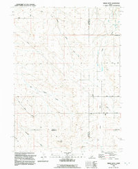
1992 Map of Indian Butte
USGS Topo · Published 1992About this map
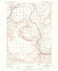
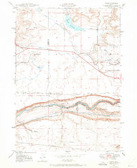
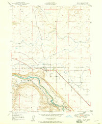
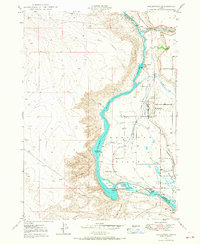
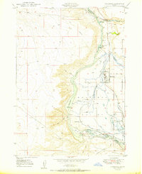
The historic Oregon Trail winds across the high desert terrain of southern Idaho, providing a direct link to the westward expansion era. This landscape at the intersection of Elmore, Owyhee, and Twin Falls counties is defined by deeply cut drainage systems like Big Pilgrim Gulch, Tuana Gulch, and Cassia Gulch. While the terrain appears largely undeveloped, the map reveals a modern layer of land use through pipelines, a Radio Facility, and localized industrial features such as a Gravel Pit and Storage Bins.
Find a feature on this map
23 named features on this map. Tap any name to fly to it.
Don’t see what you’re looking for? This feature index may not catch every label — zoom into the map to look around manually.
Map Details
Editions of this 1992 Indian Butte Map
This is the sole edition of this map. No revisions or reprints were ever made.
Other maps of this area
1947 · Pasadena Valley
USGS Topo · 1:24,000

1948 · Pasadena Valley
USGS Topo · 1:24,000

1948 · Twentymile Butte
USGS Topo · 1:24,000
1948 · Ticeska
USGS Topo · 1:24,000

1949 · Ticeska
USGS Topo · 1:24,000

1949 · Pasadena Valley
USGS Topo · 1:62,500
1949 · Bliss
USGS Topo · 1:24,000
1949 · Hagerman
USGS Topo · 1:24,000
1949 · Indian Butte
USGS Topo · 1:24,000
1950 · Hagerman
USGS Topo · 1:24,000