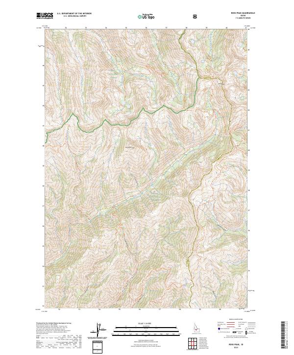
2023 Map of Ross Peak
USGS Topo · Published 2023About this map
Ross Peak and Gunsight Peak dominate this high-elevation landscape within the Boise National Forest and Sawtooth National Forest. The map detail reveals a complex network of canyons and drainage systems, most notably Narrow Canyon and the headwaters of the South Fork Ross Fork. While no permanent settlements appear, the terrain is crisscrossed by established pathways including the Senator Creek Trl and the Jumbo Creek Trl. A notable historical detail is found at the West Fork Skeleton Cr (Mill) Trl, where the parenthetical label suggests the site of a former mill along the West Fork Skeleton Creek. The drainage patterns, defined by features like Big Water Gulch and Little Water Gulch, illustrate the primary watershed routes through this protected Idaho wilderness.
Find a feature on this map
52 named features on this map. Tap any name to fly to it.
Don’t see what you’re looking for? This feature index may not catch every label — zoom into the map to look around manually.
Map Details
Editions of this 2023 Ross Peak Map
This is the sole edition of this map. No revisions or reprints were ever made.
Other maps of this area

1894 · Rocky Bar
USGS Topo · 1:125,000

1900 · Sawtooth
USGS Topo · 1:125,000

1955 · Hailey
USGS Topo · 1:250,000

1959 · Hailey
USGS Topo · 1:250,000

1962 · Hailey
USGS Topo · 1:250,000

1964 · Ross Peak
USGS Topo · 1:24,000

1964 · Cayuse Point
USGS Topo · 1:24,000
1964 · Jumbo Mtn
USGS Topo · 1:24,000
1964 · Grouse Butte
USGS Topo · 1:24,000

1964 · Marshall Peak
USGS Topo · 1:24,000