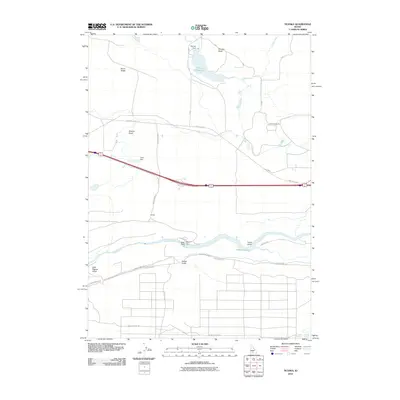
2010 Map of Ticeska
USGS Topo · Published 2010About this map
Snake River canyon walls and the surrounding high desert plateau dominate this corner of southern Idaho. The landscape is a study in water management, showing the engineered reach of the King Hill Main Canal and several significant impoundments, including Bliss Reservoir and Pioneer Reservoir. The namesake settlement of Ticeska sits north of the river, positioned between the arterial transit corridor and the volcanic terrain of Gopher Knoll and Burnt Ridge. Local infrastructure is defined by the Idaho Power Rd and the Bliss Dam, illustrating the area's role in power generation and irrigation. For those tracing the geography of the Magic Valley, the map reveals the intricate drainage of Clover Creek and the numerous gulches, such as Cassia Gulch and Tuana Gulch, that carve through the basalt-capped plains toward the river below.
Find a feature on this map
23 named features on this map. Tap any name to fly to it.
Don’t see what you’re looking for? This feature index may not catch every label — zoom into the map to look around manually.
Map Details
Editions of this 2010 Ticeska Map
This is the sole edition of this map. No revisions or reprints were ever made.
Other maps of this area

1892 · Camas Prairie
USGS Topo · 1:125,000

1893 · Camas Prairie
USGS Topo · 1:125,000

1947 · Pasadena Valley
USGS Topo · 1:24,000

1948 · Pasadena Valley
USGS Topo · 1:24,000

1948 · Twentymile Butte
USGS Topo · 1:24,000

1948 · Ticeska
USGS Topo · 1:24,000

1949 · Ticeska
USGS Topo · 1:24,000

1949 · Pasadena Valley
USGS Topo · 1:62,500

1949 · Bliss
USGS Topo · 1:24,000

1949 · Hagerman
USGS Topo · 1:24,000