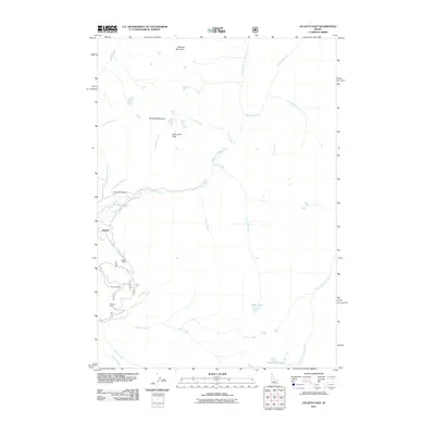
2011 Map of Atlanta East
USGS Topo · Published 2011About this map
The settlement of Atlanta anchors this portion of Elmore County, situated at the confluence of several mountain drainages and the Middle Fork Boise River. This region is defined by its deep mining heritage, evidenced by the clustered locations of the Monarch Mine, Minerva Mine, and Tolache Mine along the western slopes. These extraction sites are linked by a network of forest roads like 208 and 207, which traverse the high-elevation terrain near Greylock Mountain and Blizzard Mountain.
Find a feature on this map
31 named features on this map. Tap any name to fly to it.
Don’t see what you’re looking for? This feature index may not catch every label — zoom into the map to look around manually.
Map Details
Editions of this 2011 Atlanta East Map
This is the sole edition of this map. No revisions or reprints were ever made.
Other maps of this area

1894 · Rocky Bar
USGS Topo · 1:125,000

1900 · Sawtooth
USGS Topo · 1:125,000

1955 · Hailey
USGS Topo · 1:250,000

1959 · Hailey
USGS Topo · 1:250,000

1962 · Hailey
USGS Topo · 1:250,000

1964 · Ross Peak
USGS Topo · 1:24,000

1964 · Cayuse Point
USGS Topo · 1:24,000
1964 · Snowyside Peak
USGS Topo · 1:24,000

1964 · Marshall Peak
USGS Topo · 1:24,000
1970 · Newman Peak
USGS Topo · 1:24,000