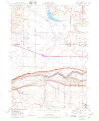
1948 Map of Ticeska
USGS Topo · Published 1979About this map
Ticeska appears as a key stop along the Union Pacific railroad line, positioned just north of the dramatic canyon carved by the Snake River. This 1948 survey, updated with late-1970s revisions, illustrates a landscape defined by the intersection of industrial transport and systematic irrigation. Water management is a central theme, evidenced by the presence of the Pioneer Reservoir in the north and the Main Canal running parallel to the river. The canyon's steep geography is highlighted by several deeply incised features like Tuana Gulch and Little Pilgrim Gulch, which drop toward the riverbed.
Find a feature on this map
20 named features on this map. Tap any name to fly to it.
Don’t see what you’re looking for? This feature index may not catch every label — zoom into the map to look around manually.
Map Details
Editions of this 1948 Ticeska Map
3 editions found
Other maps of this area

1892 · Camas Prairie
USGS Topo · 1:125,000

1893 · Camas Prairie
USGS Topo · 1:125,000

1947 · Pasadena Valley
USGS Topo · 1:24,000

1948 · Pasadena Valley
USGS Topo · 1:24,000

1948 · Twentymile Butte
USGS Topo · 1:24,000

1948 · Ticeska
USGS Topo · 1:24,000

1949 · Ticeska
USGS Topo · 1:24,000

1949 · Pasadena Valley
USGS Topo · 1:62,500

1949 · Bliss
USGS Topo · 1:24,000

1949 · Hagerman
USGS Topo · 1:24,000