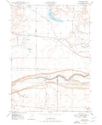
1948 Map of Ticeska
USGS Topo · Published 1976About this map
The Snake River defines the southern portion of this landscape, where the Bliss Dam and Main Canal indicate the vital role of water management in the Idaho high desert. This mid-century environment shows a complex network of Irrigation Ditches supporting land near the Elmore and Gooding County line. Transportation infrastructure is prominent, with the Union Pacific (Oregon Short Line) railroad tracking the northern bank of the river, while the King Hill Grade and Shoestring Road provide essential overland routes through the canyon. North of the river, the settlement of Ticeska sits as a quiet rail point below the rise of Gopher Knoll and the extensive Burnt Ridge. The map also documents the Pioneer Reservoir along Clover Creek, illustrating the engineered landscape required for regional agricultural development.
Find a feature on this map
19 named features on this map. Tap any name to fly to it.
Don’t see what you’re looking for? This feature index may not catch every label — zoom into the map to look around manually.
Map Details
Editions of this 1948 Ticeska Map
3 editions found
Other maps of this area

1892 · Camas Prairie
USGS Topo · 1:125,000

1893 · Camas Prairie
USGS Topo · 1:125,000

1947 · Pasadena Valley
USGS Topo · 1:24,000

1948 · Pasadena Valley
USGS Topo · 1:24,000

1948 · Twentymile Butte
USGS Topo · 1:24,000

1948 · Ticeska
USGS Topo · 1:24,000

1949 · Ticeska
USGS Topo · 1:24,000

1949 · Pasadena Valley
USGS Topo · 1:62,500

1949 · Bliss
USGS Topo · 1:24,000

1949 · Hagerman
USGS Topo · 1:24,000