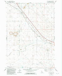
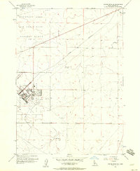
1992 Map of Crater Rings
USGS Topo · Published 1992About this map
Crater Rings, a pair of volcanic pit craters, dominate this high desert landscape in Elmore County. The terrain is marked by the volcanic legacy of the Snake River Plain, featuring landmarks such as Cinder Butte and North Crater. Human infrastructure is defined by the diagonal corridor of the Old Highway and a primary Pipeline cutting through the arid flats. To the south, the Snake River Birds of Prey Area encompasses the dramatic rim of the Snake River canyon, where Canyon Creek meets the main waterway. The map also documents the northern edge of the Mountain Home Air Force Base, including its military reservation boundary and Small Arms Range. Sparse settlements like Cleft and Sebree are situated along the transportation routes, reflecting the region's scattered ranching and military presence during the late twentieth century.
Find a feature on this map
22 named features on this map. Tap any name to fly to it.
Don’t see what you’re looking for? This feature index may not catch every label — zoom into the map to look around manually.
Map Details
Editions of this 1992 Crater Rings Map
This is the sole edition of this map. No revisions or reprints were ever made.
Other maps of this area

1892 · Mountain Home
USGS Topo · 1:125,000

1893 · Mountain Home
USGS Topo · 1:125,000

1955 · Hailey
USGS Topo · 1:250,000
1956 · Mountain Home South
USGS Topo · 1:24,000
1956 · Cinder Cone Butte
USGS Topo · 1:24,000

1956 · Crater Rings
USGS Topo · 1:24,000

1956 · Mountain Home North
USGS Topo · 1:24,000
1956 · Crater Rings SW
USGS Topo · 1:24,000

1956 · Mountain Home
USGS Topo · 1:62,500
1956 · Crater Rings SE
USGS Topo · 1:24,000