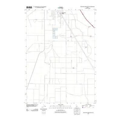
2010 Map of Mountain Home South
USGS Topo · Published 2010About this map
Mountain Home serves as the northern anchor of this landscape, where the high desert plateau meets the infrastructure of early 21st-century agricultural and transit corridors. The layout reveals a transition from the urban grid of the town into the surrounding rural tracts of Elmore County, defined by the East Side Canal and West Side Canal. These water systems, along with the Groefsema Dam, emphasize the critical role of irrigation in sustaining the productivity of areas like Slade Flat and Clover Hollow. Historical transit patterns are visible through labels such as the Old Mountain City Mtn Home Rd and the Freight Trl, which offer clues to the movement of goods and people across the region before modern highway dominance. Local farming heritage is noted in the presence of Beet Dump Rd, signifying the area's industrial connection to the regional sugar beet economy.
Find a feature on this map
30 named features on this map. Tap any name to fly to it.
Don’t see what you’re looking for? This feature index may not catch every label — zoom into the map to look around manually.
Map Details
Editions of this 2010 Mountain Home South Map
This is the sole edition of this map. No revisions or reprints were ever made.
Other maps of this area

1892 · Mountain Home
USGS Topo · 1:125,000

1893 · Mountain Home
USGS Topo · 1:125,000

1947 · Bruneau
USGS Topo · 1:62,500

1947 · Indian Cove
USGS Topo · 1:24,000

1947 · Sand Dunes
USGS Topo · 1:24,000

1947 · Bruneau
USGS Topo · 1:24,000

1948 · Sand Dunes
USGS Topo · 1:24,000

1948 · Indian Cove
USGS Topo · 1:24,000
1948 · Bruneau
USGS Topo · 1:24,000

1948 · Indian Cove
USGS Topo · 1:62,500