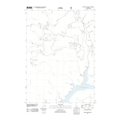
2011 Map of House Mountain
USGS Topo · Published 2011About this map
House Mountain dominates the western portion of this Boise National Forest landscape, where steep drainages feed the expansive Anderson Ranch Reservoir. In 2011, this area served as a significant recreational hub for Idaho outdoorsmen, anchored by a series of waterside sites including Castle Rock Campground, Evans Creek Campground, and the Little Wilson Creek Campground. The Rhead Dam sits near the reservoir's western arm, managing the flow of the South Fork Boise River system. Moving north from the shoreline, the terrain climbs toward White Flat and the high ridges defined by House Mountain Rd. A dense network of seasonal drainages such as Fall Creek, Myrtle Creek, and Knox Creek carve through the foothills, illustrating the complex hydrology that feeds the reservoir. For those tracing the human footprint in the backcountry, the presence of the Fall Creek Lodge and Ice Springs Campground highlights the established corridors of access into the Elmore County wilderness.
Find a feature on this map
38 named features on this map. Tap any name to fly to it.
Don’t see what you’re looking for? This feature index may not catch every label — zoom into the map to look around manually.
Map Details
Editions of this 2011 House Mountain Map
This is the sole edition of this map. No revisions or reprints were ever made.
Other maps of this area

1892 · Mountain Home
USGS Topo · 1:125,000

1892 · Camas Prairie
USGS Topo · 1:125,000

1893 · Mountain Home
USGS Topo · 1:125,000

1893 · Camas Prairie
USGS Topo · 1:125,000

1894 · Idaho Basin
USGS Topo · 1:125,000

1894 · Rocky Bar
USGS Topo · 1:125,000

1955 · Hailey
USGS Topo · 1:250,000

1959 · Hailey
USGS Topo · 1:250,000

1960 · Danskin Peak
USGS Topo · 1:62,500

1962 · Hailey
USGS Topo · 1:250,000