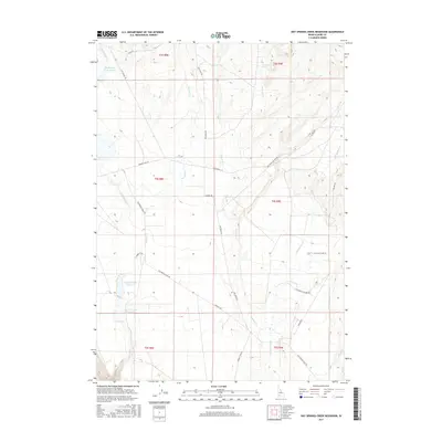
2017 Map of Hot Springs Creek Reservoir
USGS Topo · Published 2017About this map
Old Oregon Trail Rd cuts a historical diagonal across this high desert landscape, tracing a legacy of western migration through Elmore County. The terrain is defined by a series of intermittent drainages and essential water sources, including the Hot Springs Cr Reservoir in the northwest and the paired Upper Teapot Reservoir and Lower Teapot Reservoir further south. These catchments, along with named points like Lone Tree Spring, highlight the critical role of water management in a region otherwise characterized by expansive rangeland. The map illustrates a network of rural routes such as Hammett Hill Rd and Walker Rd that connect isolated sections of the Idaho interior, showing how modern land use continues to follow the paths established by early settlers and topographic necessity.
Find a feature on this map
30 named features on this map. Tap any name to fly to it.
Don’t see what you’re looking for? This feature index may not catch every label — zoom into the map to look around manually.
Map Details
Editions of this 2017 Hot Springs Creek Reservoir Map
This is the sole edition of this map. No revisions or reprints were ever made.
Other maps of this area

1892 · Mountain Home
USGS Topo · 1:125,000

1892 · Camas Prairie
USGS Topo · 1:125,000

1893 · Mountain Home
USGS Topo · 1:125,000

1893 · Camas Prairie
USGS Topo · 1:125,000

1947 · Indian Cove
USGS Topo · 1:24,000

1947 · Hammett
USGS Topo · 1:24,000

1947 · Glenns Ferry
USGS Topo · 1:24,000

1948 · Hammett
USGS Topo · 1:24,000

1948 · Glenns Ferry
USGS Topo · 1:24,000

1948 · Indian Cove
USGS Topo · 1:24,000