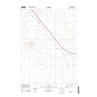
2013 Map of Crater Rings
USGS Topo · Published 2013About this map
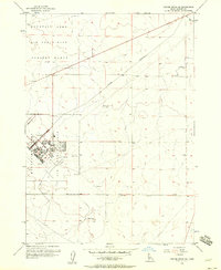
Crater Rings, a pair of distinctive pit craters, dominate the volcanic landscape of this portion of Elmore County. This 2013 survey documents a high desert region marked by significant infrastructure and transportation corridors, including the path of Ditto Creek Rd and the Union Pacific Railroad line that passes through the rural sidings of Cleft and Sebree. The local road network is well-defined by family and descriptive names such as Faulkner Rd, Desert Duck Rd, and N Cinder Butte Rd, reflecting the area's ongoing use for ranching and transit. Seasonal drainage is captured along Canyon Cr, which meanders across the southern sections of the quadrangle. The map provides a clear look at the intersection of natural volcanic geology and the human engineering required to navigate the Snake River Plain.
Find a feature on this map
19 named features on this map. Tap any name to fly to it.
Don’t see what you’re looking for? This feature index may not catch every label — zoom into the map to look around manually.
Map Details
Editions of this 2013 Crater Rings Map
This is the sole edition of this map. No revisions or reprints were ever made.
Other maps of this area

1892 · Mountain Home
USGS Topo · 1:125,000

1893 · Mountain Home
USGS Topo · 1:125,000

1955 · Hailey
USGS Topo · 1:250,000
1956 · Mountain Home South
USGS Topo · 1:24,000
1956 · Cinder Cone Butte
USGS Topo · 1:24,000

1956 · Crater Rings
USGS Topo · 1:24,000

1956 · Mountain Home North
USGS Topo · 1:24,000
1956 · Crater Rings SW
USGS Topo · 1:24,000

1956 · Mountain Home
USGS Topo · 1:62,500
1956 · Crater Rings SE
USGS Topo · 1:24,000