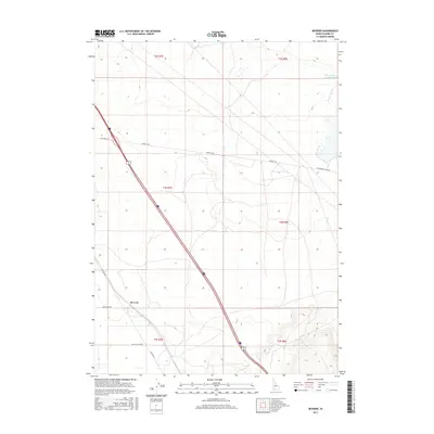
2017 Map of Reverse
USGS Topo · Published 2017About this map
Reverse sits at the heart of this Southern Idaho landscape, where the high desert meets the structured irrigation and transportation networks of Elmore County. The terrain is defined by the seasonal flow of Hot Springs Cr and Dry Cr, with the Hot Springs Cr Reservoir appearing in the northeastern corner. This area serves as a significant corridor for historical and modern travel, preserving the path of the Old Oregon Trail Rd alongside more recent thoroughfares. The presence of Beet Dump Rd reflects the local agricultural economy, specifically the sugar beet industry common to the Snake River Plain. Local transit is further documented through family or locality-named routes such as Billy Rio Loop Rd and the long-stretching Bennett Rd.
Find a feature on this map
15 named features on this map. Tap any name to fly to it.
Don’t see what you’re looking for? This feature index may not catch every label — zoom into the map to look around manually.
Map Details
Editions of this 2017 Reverse Map
This is the sole edition of this map. No revisions or reprints were ever made.
Other maps of this area

1892 · Mountain Home
USGS Topo · 1:125,000

1892 · Camas Prairie
USGS Topo · 1:125,000

1893 · Mountain Home
USGS Topo · 1:125,000

1893 · Camas Prairie
USGS Topo · 1:125,000

1947 · Indian Cove
USGS Topo · 1:24,000

1947 · Hammett
USGS Topo · 1:24,000

1947 · Sand Dunes
USGS Topo · 1:24,000

1948 · Sand Dunes
USGS Topo · 1:24,000

1948 · Hammett
USGS Topo · 1:24,000

1948 · Indian Cove
USGS Topo · 1:24,000