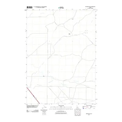
2010 Map of Mayfield SE
USGS Topo · Published 2010About this map
Camas County Airport and a network of arterial ranching roads define this southern Idaho landscape near the Elmore and Camas county line. The terrain is marked by a complex drainage system where Soles Rest Creek and Ditto Creek flow through open country towards the southwest. These watercourses influenced the placement of early 21st-century agricultural operations, including Bennett Ranch and Willow Ranch, which serve as key landmarks in this sparsely populated region.
Find a feature on this map
14 named features on this map. Tap any name to fly to it.
Don’t see what you’re looking for? This feature index may not catch every label — zoom into the map to look around manually.
Map Details
Editions of this 2010 Mayfield SE Map
This is the sole edition of this map. No revisions or reprints were ever made.
Other maps of this area

1892 · Mountain Home
USGS Topo · 1:125,000

1893 · Mountain Home
USGS Topo · 1:125,000

1955 · Hailey
USGS Topo · 1:250,000
1956 · Cinder Cone Butte
USGS Topo · 1:24,000

1956 · Crater Rings
USGS Topo · 1:24,000

1956 · Mountain Home North
USGS Topo · 1:24,000

1956 · Mountain Home
USGS Topo · 1:62,500

1959 · Hailey
USGS Topo · 1:250,000

1960 · Mayfield
USGS Topo · 1:62,500

1960 · Danskin Peak
USGS Topo · 1:62,500