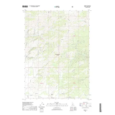
2020 Map of Prairie
USGS Topo · Published 2020About this map
Prairie and the surrounding high-country plateau of Smith Prairie define this portion of the Boise National Forest. The landscape is shaped by volcanic geography, evident in labels like Lava Mountain and Lava Ridge, which transition into a complex system of drainages such as Smith Creek and Strawberry Creek. Infrastructure is concentrated in the southern flats, where the Smith Prairie Airport and Pierce Ditch reflect the localized ranching and aviation history of this Elmore County region. Transportation into the higher elevations is facilitated by a network of specialized routes, including Rattlesnake Ridge and the Prairie-Pine Road. The terrain rises sharply to the north toward Rattlesnake Mountain and the high waters of North Star Lake, while the North Fork Valley marks the western edge of the quadrangle.
Find a feature on this map
49 named features on this map. Tap any name to fly to it.
Don’t see what you’re looking for? This feature index may not catch every label — zoom into the map to look around manually.
Map Details
Editions of this 2020 Prairie Map
This is the sole edition of this map. No revisions or reprints were ever made.
Other maps of this area

1892 · Mountain Home
USGS Topo · 1:125,000

1892 · Camas Prairie
USGS Topo · 1:125,000

1893 · Mountain Home
USGS Topo · 1:125,000

1893 · Camas Prairie
USGS Topo · 1:125,000

1894 · Idaho Basin
USGS Topo · 1:125,000

1894 · Rocky Bar
USGS Topo · 1:125,000

1955 · Hailey
USGS Topo · 1:250,000

1959 · Hailey
USGS Topo · 1:250,000

1960 · Danskin Peak
USGS Topo · 1:62,500

1962 · Hailey
USGS Topo · 1:250,000