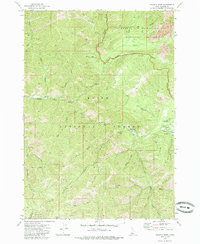
1972 Map of Atlanta West
USGS Topo · Published 1985About this map
Atlanta sits at the eastern edge of this landscape, a remote settlement defined by its position along the Middle Fork Boise River. In the early 1970s, the community remained tied to the surrounding wilderness through the Atlanta Power Station and a nearby Forest Service Station. The terrain is deeply carved by drainage systems like Little Queens River and Black Warrior Creek, where narrow valleys and steep ridges dictate the placement of early infrastructure. Prospectors and miners left their mark throughout the hills, as seen with several Prospect and Mine labels, particularly near Queens River. Recreational and administrative footprints are evident at Riverside Campground and Queens River Campground, while the presence of a Spring (Hot) near Snyder Creek suggests the geothermal character of the area. This map documents a high-country economy transitioning from its mining roots toward forest management and remote recreation within the Boise National Forest.
Find a feature on this map
46 named features on this map. Tap any name to fly to it.
Don’t see what you’re looking for? This feature index may not catch every label — zoom into the map to look around manually.
Map Details
Editions of this 1972 Atlanta West Map
3 editions found
Other maps of this area

1894 · Rocky Bar
USGS Topo · 1:125,000

1955 · Hailey
USGS Topo · 1:250,000

1959 · Hailey
USGS Topo · 1:250,000

1962 · Hailey
USGS Topo · 1:250,000

1964 · Ross Peak
USGS Topo · 1:24,000

1964 · Cayuse Point
USGS Topo · 1:24,000
1964 · Rocky Bar
USGS Topo · 1:24,000
1972 · Atlanta East
USGS Topo · 1:24,000
1972 · Swanholm Peak
USGS Topo · 1:24,000
1972 · Phifer Creek
USGS Topo · 1:24,000