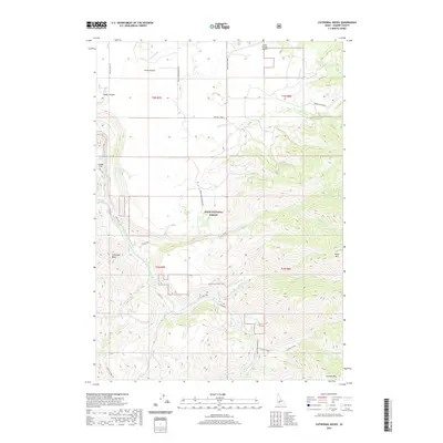
2020 Map of Cathedral Rocks
USGS Topo · Published 2020About this map
Smith Prairie serves as a focal point in this portion of the Boise National Forest, situated above the deeply carved valley of the South Fork Boise River. The landscape is defined by the sharp transition from the flat agricultural and aviation grounds near Smith Prairie Airport to the complex drainage systems of Rock Creek and Dead Horse Cr. To the west, Black Canyon and Cougar Flat mark the descent toward the river, while landmarks like Cathedral Rocks and House Mtn dominate the eastern elevations.
Find a feature on this map
39 named features on this map. Tap any name to fly to it.
Don’t see what you’re looking for? This feature index may not catch every label — zoom into the map to look around manually.
Map Details
Editions of this 2020 Cathedral Rocks Map
This is the sole edition of this map. No revisions or reprints were ever made.
Other maps of this area

1892 · Mountain Home
USGS Topo · 1:125,000

1892 · Camas Prairie
USGS Topo · 1:125,000

1893 · Mountain Home
USGS Topo · 1:125,000

1893 · Camas Prairie
USGS Topo · 1:125,000

1894 · Idaho Basin
USGS Topo · 1:125,000

1894 · Rocky Bar
USGS Topo · 1:125,000

1955 · Hailey
USGS Topo · 1:250,000

1959 · Hailey
USGS Topo · 1:250,000

1960 · Danskin Peak
USGS Topo · 1:62,500

1962 · Hailey
USGS Topo · 1:250,000