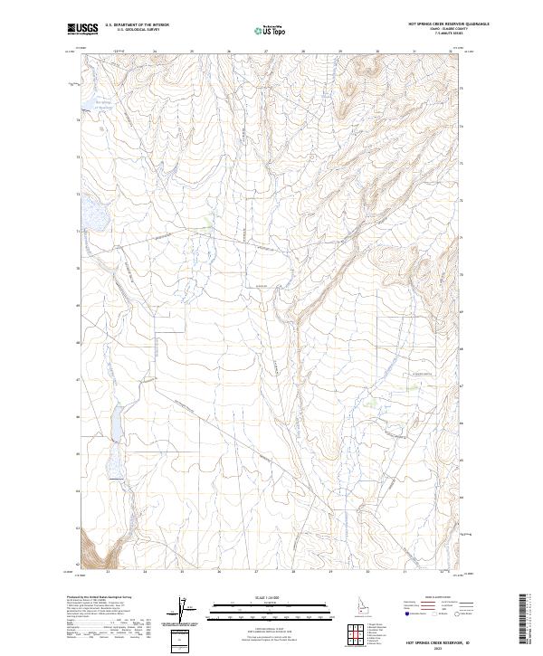
2023 Map of Hot Springs Creek Reservoir
USGS Topo · Published 2023About this map
Hot Springs Cr Reservoir serves as a focal point for this section of Elmore County, where the high desert landscape is defined by the drainages of Hot Springs Creek, Bennett Creek, and Ryegrass Creek. The terrain is marked by a network of ranching and historical transit corridors, most notably the path of Old Oregon Trail Rd, which traverses the southern half of the quadrangle. This area retains its agrarian and remote character, as evidenced by a series of long-established routes such as Hammett Hill Rd and Walker Rd. Water remains the most vital resource for local land use, highlighted by the location of Lone Tree Spring and the steady course of Cold Springs Creek. The mapping reveals a sparse but deliberate settlement pattern typical of the Snake River Plain hinterlands, where every named waterway and road transition indicates decades of local navigation and land management.
Find a feature on this map
27 named features on this map. Tap any name to fly to it.
Don’t see what you’re looking for? This feature index may not catch every label — zoom into the map to look around manually.
Map Details
Editions of this 2023 Hot Springs Creek Reservoir Map
This is the sole edition of this map. No revisions or reprints were ever made.
Other maps of this area

1892 · Mountain Home
USGS Topo · 1:125,000

1892 · Camas Prairie
USGS Topo · 1:125,000

1893 · Mountain Home
USGS Topo · 1:125,000

1893 · Camas Prairie
USGS Topo · 1:125,000

1947 · Indian Cove
USGS Topo · 1:24,000

1947 · Hammett
USGS Topo · 1:24,000

1947 · Glenns Ferry
USGS Topo · 1:24,000

1948 · Hammett
USGS Topo · 1:24,000

1948 · Glenns Ferry
USGS Topo · 1:24,000

1948 · Indian Cove
USGS Topo · 1:24,000