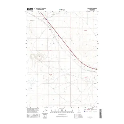
2017 Map of Crater Rings
USGS Topo · Published 2017About this map
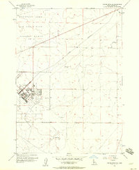
Crater Rings dominate the central landscape of this Elmore County region, representing a distinct volcanic landmark within the high desert terrain. The area is defined by its transit history, following the path of the Old Oregon Trail Hwy which slices diagonally across the quadrangle. Small settlements like Cleft and Sebree are situated along this primary corridor, marking points of activity in an otherwise open landscape of sagebrush and lava flows. Drainage is limited to the intermittent Canyon Cr, which meanders through the southern half of the territory. The survey details a network of secondary roads, including Simco Cutoff Rd and Cinder Butte Rd, that provide access to the vast townships of t2s r5e and t3s r6e. This 2017 edition documents the contemporary infrastructure overlaying these ancient geologic features and historic migration routes.
Find a feature on this map
26 named features on this map. Tap any name to fly to it.
Don’t see what you’re looking for? This feature index may not catch every label — zoom into the map to look around manually.
Map Details
Editions of this 2017 Crater Rings Map
This is the sole edition of this map. No revisions or reprints were ever made.
Other maps of this area

1892 · Mountain Home
USGS Topo · 1:125,000

1893 · Mountain Home
USGS Topo · 1:125,000

1955 · Hailey
USGS Topo · 1:250,000
1956 · Mountain Home South
USGS Topo · 1:24,000
1956 · Cinder Cone Butte
USGS Topo · 1:24,000

1956 · Crater Rings
USGS Topo · 1:24,000

1956 · Mountain Home North
USGS Topo · 1:24,000
1956 · Crater Rings SW
USGS Topo · 1:24,000

1956 · Mountain Home
USGS Topo · 1:62,500
1956 · Crater Rings SE
USGS Topo · 1:24,000