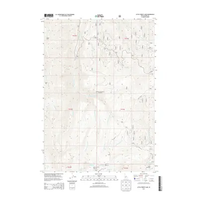
2013 Map of Little Trinity Lake
USGS Topo · Published 2013About this map
Boise National Forest dominates this high-elevation landscape within the Trinity Mountains, where a complex network of river forks and alpine lakes defines the geography. The map captures a concentrated recreation area centered around Little Trinity Lake and Big Trinity Lake, featuring the Little Trinity Lake Campground and the Little Roaring River Lake Campground. These sites serve as gateways to the surrounding wilderness, including the headwaters of the Roaring River, which splits into several distinct branches such as the Middle Fork Roaring River and E Fork Roaring River. Infrastructure in this part of Elmore County is limited to vital forest access routes like Trinity Ridge Rd and Trinity Mountain Rd, which navigate the steep terrain between peaks like Sheep Mtn and the various gulches. The drainage patterns are intricate, with several creeks like Whiskey Jack Cr and Rainbow Cr feeding into the larger river systems that carve through the mountain range.
Find a feature on this map
33 named features on this map. Tap any name to fly to it.
Don’t see what you’re looking for? This feature index may not catch every label — zoom into the map to look around manually.
Map Details
Editions of this 2013 Little Trinity Lake Map
This is the sole edition of this map. No revisions or reprints were ever made.
Other maps of this area

1894 · Idaho Basin
USGS Topo · 1:125,000

1894 · Rocky Bar
USGS Topo · 1:125,000

1955 · Hailey
USGS Topo · 1:250,000

1959 · Hailey
USGS Topo · 1:250,000

1962 · Hailey
USGS Topo · 1:250,000
1964 · Featherville
USGS Topo · 1:24,000
1964 · Prairie
USGS Topo · 1:24,000
1964 · Trinity Mtn
USGS Topo · 1:24,000

1964 · Little Trinity Lake
USGS Topo · 1:24,000

1964 · Sheep Creek
USGS Topo · 1:24,000