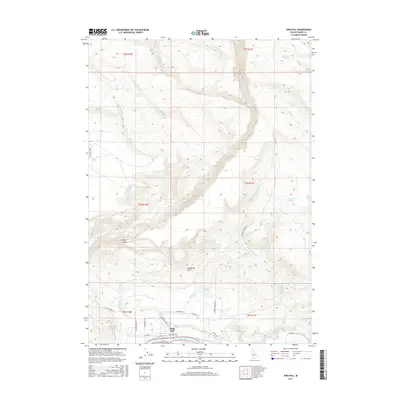
2017 Map of King Hill
USGS Topo · Published 2017About this map
The Snake River defines the southern boundary of this high desert terrain, where the settlement of King Hill serves as a small hub of activity in the early 21st century. The landscape is characterized by a complex network of seasonal drainages and irrigation efforts, including Walker Ditch and Ricke Ditch, which redirect water across the arid flats. Rising above the draws, Kings Crown stands as a prominent topographical feature overlooking the confluence of King Hill Cr and the river. Numerous springs, such as Bullet Spring, Twin Springs, and Corker Spring, are scattered throughout the higher elevations, indicating the critical role of groundwater in this part of Elmore County. Local transit is managed through a grid of rural roads like Pitchfork Rd and Old Hwy 30, tracing the contours of the land between the water-rich bottomlands and the northern plateaus.
Find a feature on this map
42 named features on this map. Tap any name to fly to it.
Don’t see what you’re looking for? This feature index may not catch every label — zoom into the map to look around manually.
Map Details
Editions of this 2017 King Hill Map
This is the sole edition of this map. No revisions or reprints were ever made.
Other maps of this area

1892 · Camas Prairie
USGS Topo · 1:125,000

1893 · Camas Prairie
USGS Topo · 1:125,000

1947 · Glenns Ferry
USGS Topo · 1:24,000

1947 · Pasadena Valley
USGS Topo · 1:24,000

1948 · Pasadena Valley
USGS Topo · 1:24,000

1948 · Glenns Ferry
USGS Topo · 1:24,000

1948 · Glenns Ferry
USGS Topo · 1:62,500

1948 · Ticeska
USGS Topo · 1:24,000

1949 · Ticeska
USGS Topo · 1:24,000

1949 · Pasadena Valley
USGS Topo · 1:62,500