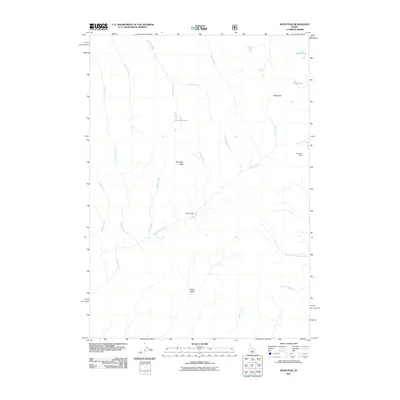
2011 Map of Ross Peak
USGS Topo · Published 2011About this map
Ross Peak and Gunsight Peak dominate this corner of Elmore County, defining a landscape shaped by high alpine basins and a complex drainage network. The presence of the Red Horse Mine on the eastern edge of the quadrangle points to the mining history that has long drawn prospectors to these mountains. This map documents a wilderness character where names like Camp Gulch and Fern Gulch suggest early temporary settlements or landmarks along the many waterways. The high country is dotted with small mountain basins including Bass Lakes, Goat Lake, and Grouse Lakes, which serve as the headwaters for a web of streams such as Willow Creek and Heather Creek. This 2011 survey records the modern state of these remote resource-rich lands and their seasonal access routes.
Find a feature on this map
23 named features on this map. Tap any name to fly to it.
Don’t see what you’re looking for? This feature index may not catch every label — zoom into the map to look around manually.
Map Details
Editions of this 2011 Ross Peak Map
This is the sole edition of this map. No revisions or reprints were ever made.
Other maps of this area

1894 · Rocky Bar
USGS Topo · 1:125,000

1900 · Sawtooth
USGS Topo · 1:125,000

1955 · Hailey
USGS Topo · 1:250,000

1959 · Hailey
USGS Topo · 1:250,000

1962 · Hailey
USGS Topo · 1:250,000

1964 · Ross Peak
USGS Topo · 1:24,000

1964 · Cayuse Point
USGS Topo · 1:24,000
1964 · Jumbo Mtn
USGS Topo · 1:24,000
1964 · Grouse Butte
USGS Topo · 1:24,000

1964 · Marshall Peak
USGS Topo · 1:24,000