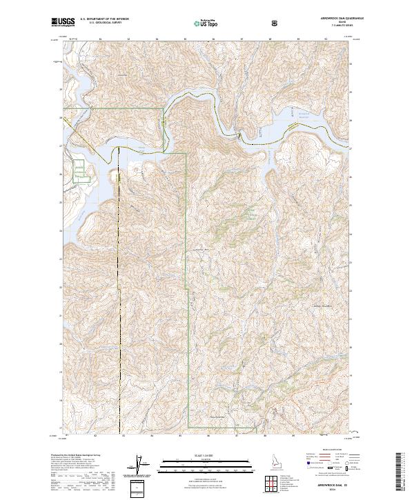
2024 Map of Arrowrock Dam
USGS Topo · Published 2024About this map
The Boise River forms the central hydrological axis of this 2024 map, feeding into the upper reaches of Lucky Peak Lake and the southeastern expanse of the Arrowrock Reservoir. This area marks a significant convergence of county lines, where the boundaries of Ada and Boise counties meet Elmore County amidst the high-elevation terrain of the Danskin Mountains. The landscape is characterized by a dense network of gulches and creeks, including Browns Gulch, Sams Gulch, and Station Creek, which drain the ridges surrounding Kepros Mtn and Three Point Mtn.
Find a feature on this map
39 named features on this map. Tap any name to fly to it.
Don’t see what you’re looking for? This feature index may not catch every label — zoom into the map to look around manually.
Map Details
Editions of this 2024 Arrowrock Dam Map
This is the sole edition of this map. No revisions or reprints were ever made.
Other maps of this area

1892 · Mountain Home
USGS Topo · 1:125,000

1892 · Boise
USGS Topo · 1:125,000

1892 · Bisuka
USGS Topo · 1:125,000

1893 · Mountain Home
USGS Topo · 1:125,000

1894 · Bisuka
USGS Topo · 1:125,000

1894 · Idaho Basin
USGS Topo · 1:125,000

1897 · Boise
USGS Topo · 1:125,000

1949 · Robie Creek
USGS Topo · 1:24,000

1954 · Boise
USGS Topo · 1:62,500

1955 · Hailey
USGS Topo · 1:250,000