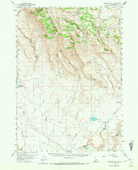
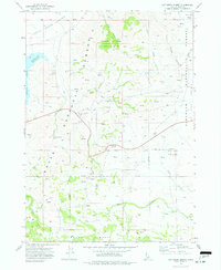
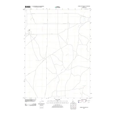
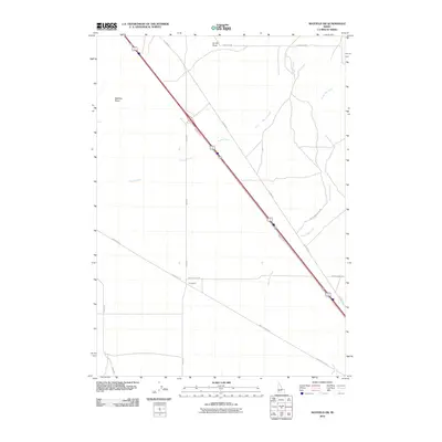
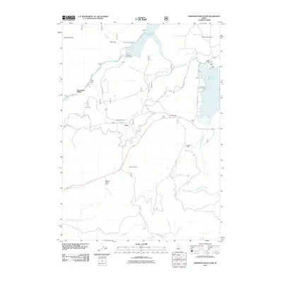
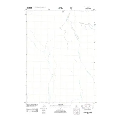
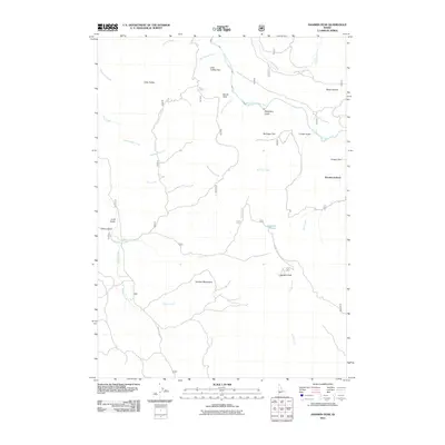
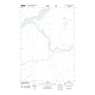
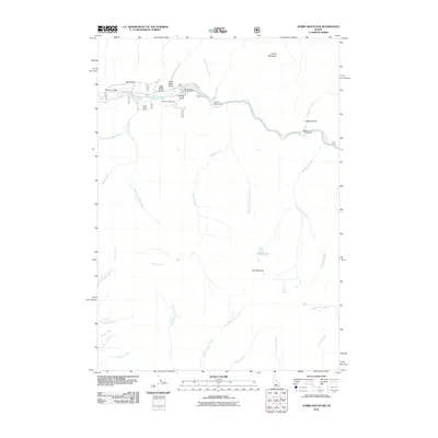
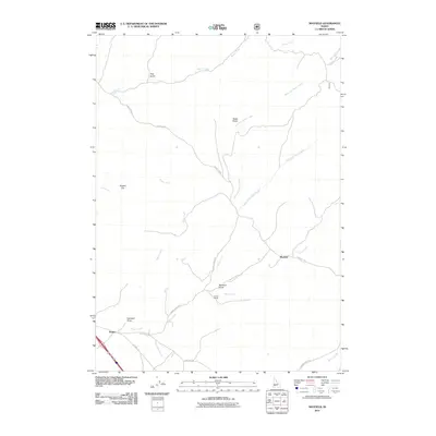
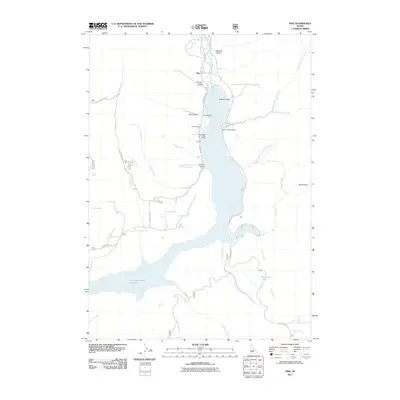
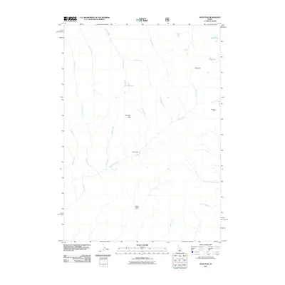
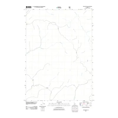
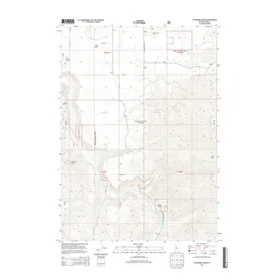
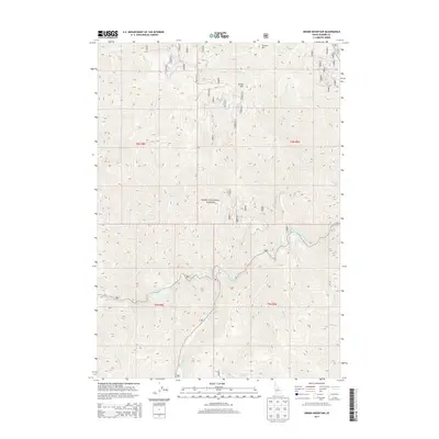
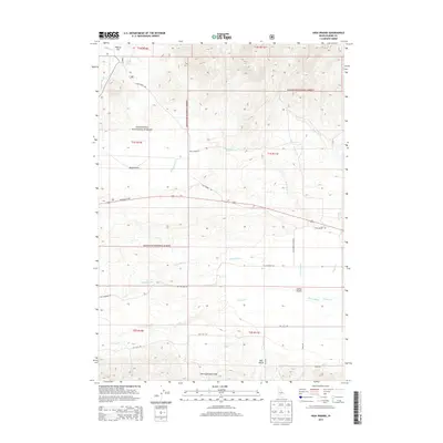
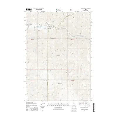
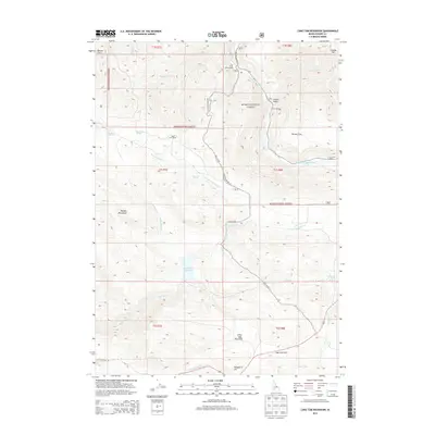
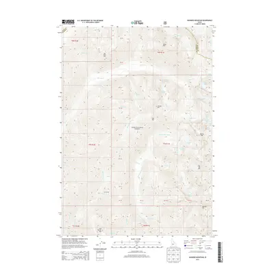
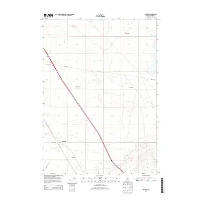
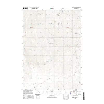
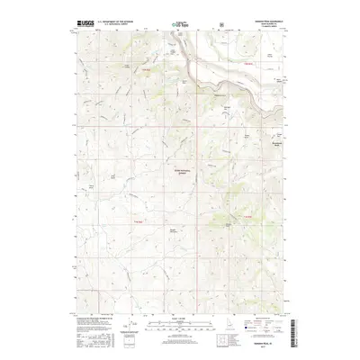
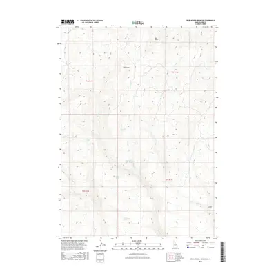
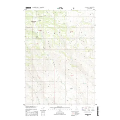
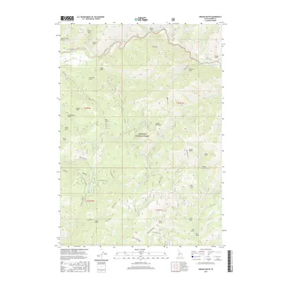
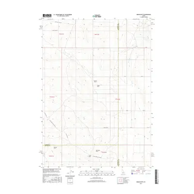
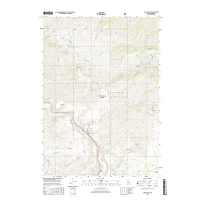
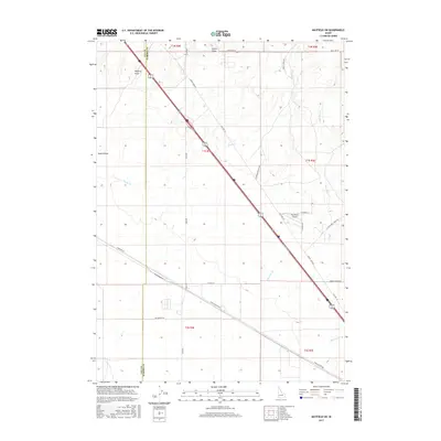
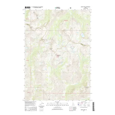
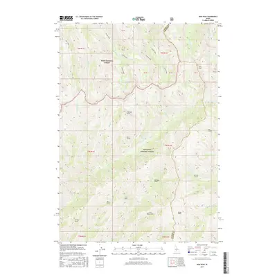
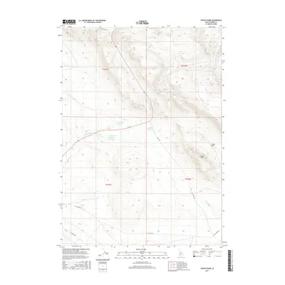
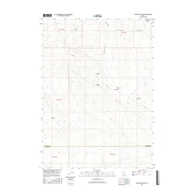
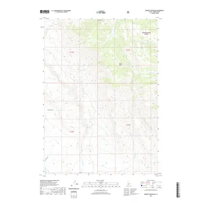
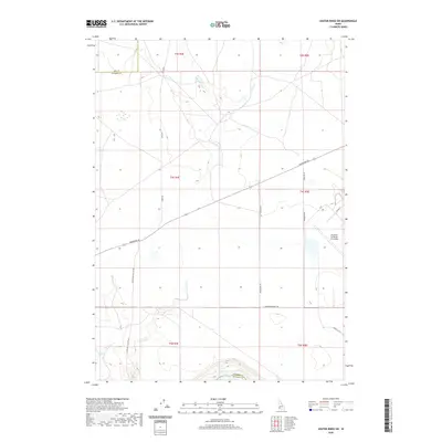
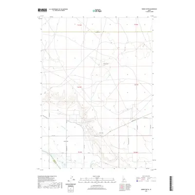
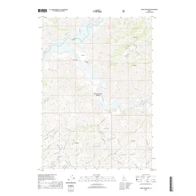
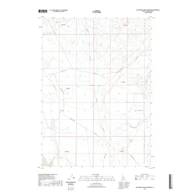
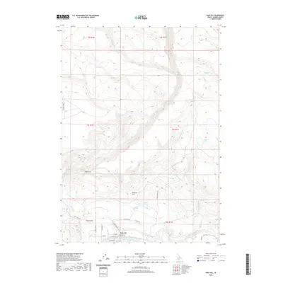
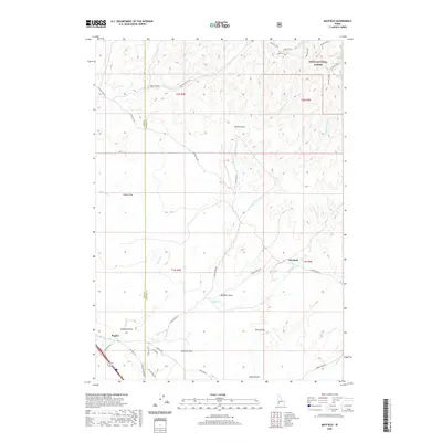
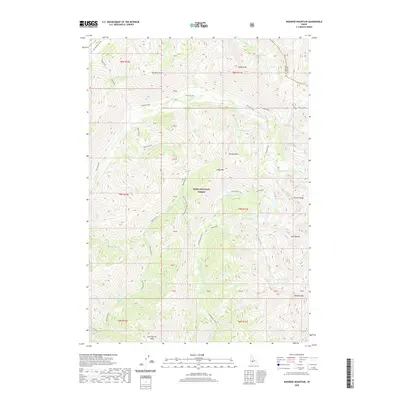
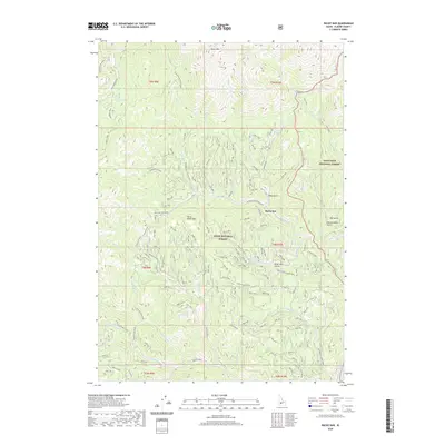
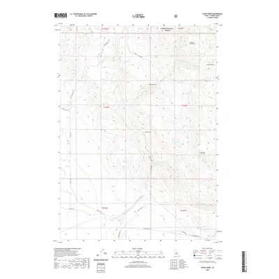
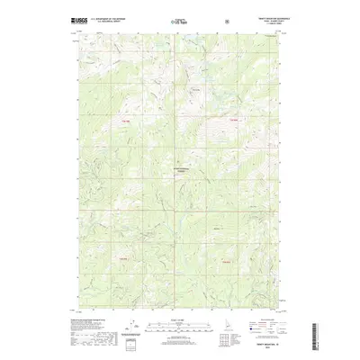
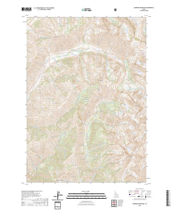
1972 Map of Nahneke Mtn
USGS Topo · Published 1979About this map
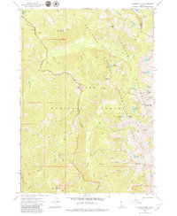
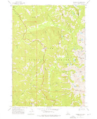
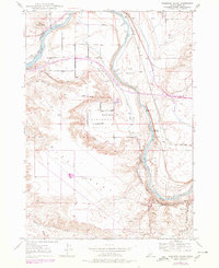
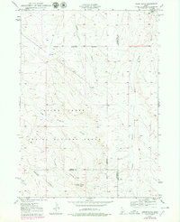
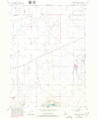
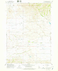
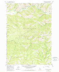
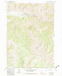
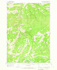
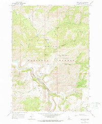
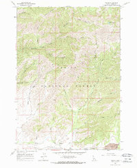
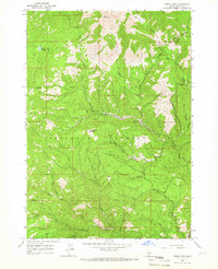
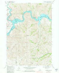
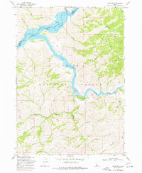
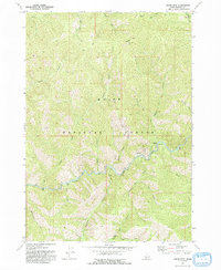
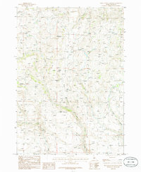
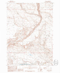
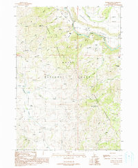
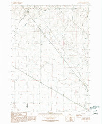
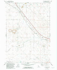
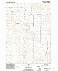
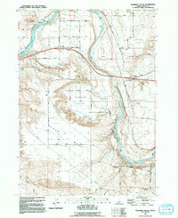
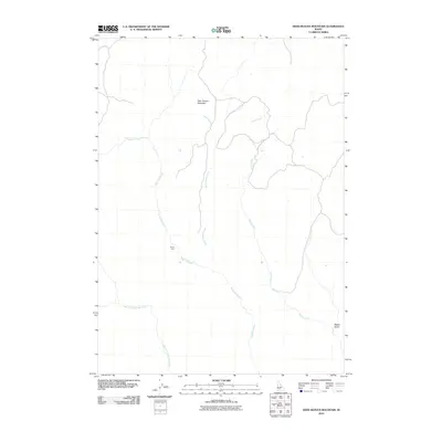
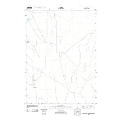
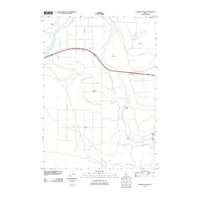
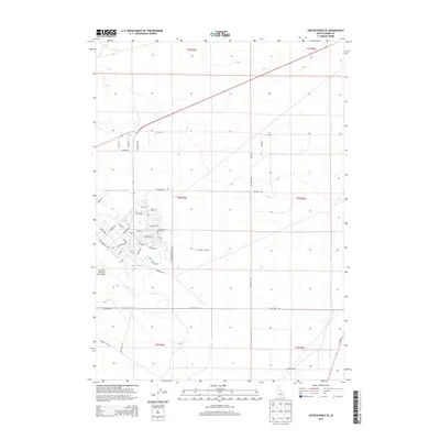
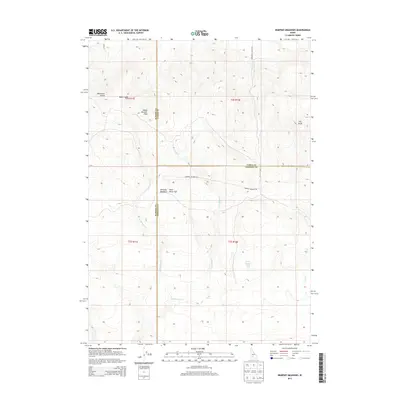
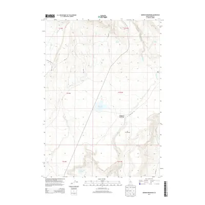
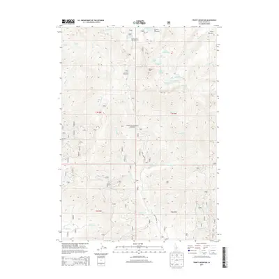
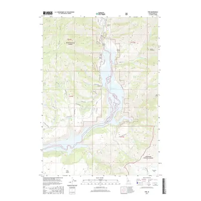
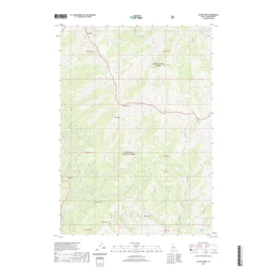
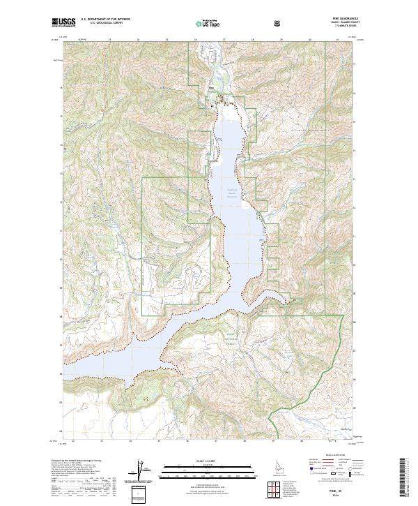
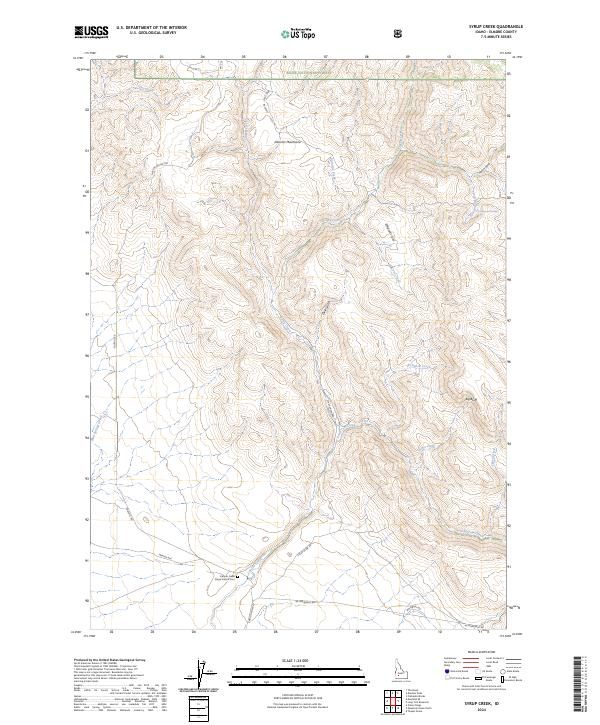
Overlook Mill (Ruins) and a nearby Mine stand as primary evidence of early industrial activity in this high-altitude landscape within the Boise National Forest and Sawtooth National Forest. The geography is defined by a dense network of drainages including Black Warrior Creek, Little Queens River, and Townsend Creek, which carve through the terrain between prominent summits like Nahneke Mtn and Smoky Peak. Evidence of historic movement is found in the extensive Pack Trail system that traverses High Pass and connects remote water features such as Rock Island Lake and Scenic Lake. The map illustrates a transitional wilderness where the Sawtooth Wilderness Area meets the county line between Boise Co and Elmore Co, documenting a period when these backcountry trails were the primary means of navigating the high basins and alpine falls like Scenic Falls.
Find a feature on this map
45 named features on this map. Tap any name to fly to it.
Don’t see what you’re looking for? This feature index may not catch every label — zoom into the map to look around manually.
Map Details
Editions of this 1972 Nahneke Mtn Map
2 editions found
Historical Maps of Elmore County Through Time
353 maps found

1892 Camas Prairie
Elmore County, ID
1893 Camas Prairie
Elmore County, ID
1894 Rocky Bar
Elmore County, ID

1947 Dorsey Butte
Elmore County, ID
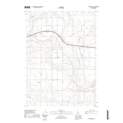
1947 Pasadena Valley
Elmore County, ID
1948 Dorsey Butte
Elmore County, ID

1948 Grindstone Butte
Elmore County, ID

1948 Pasadena Valley
Elmore County, ID
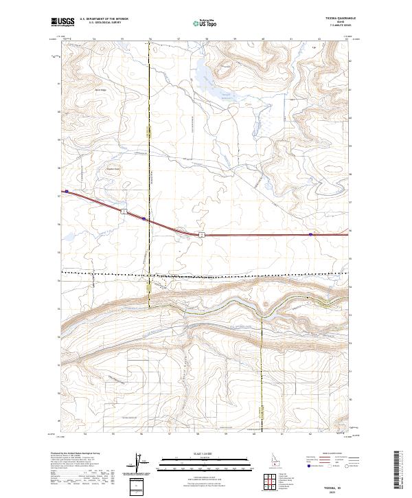
1948 Ticeska
Elmore County, ID

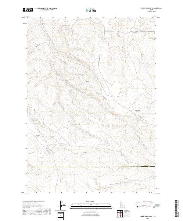
1948 Twentymile Butte
Elmore County, ID
1949 Grindstone Butte
Elmore County, ID
1949 Indian Butte
Elmore County, ID

1949 Pasadena Valley
Elmore County, ID

1949 Ticeska
Elmore County, ID
1950 Indian Butte
Elmore County, ID
1956 Cinder Cone Butte
Elmore County, ID
1956 Crater Rings
Elmore County, ID

1956 Crater Rings SE
Elmore County, ID
1956 Crater Rings SW
Elmore County, ID
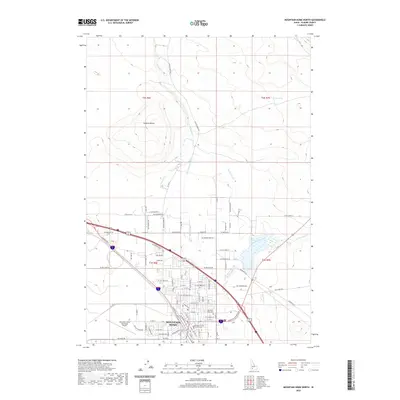
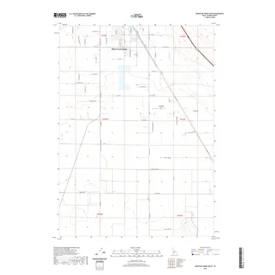
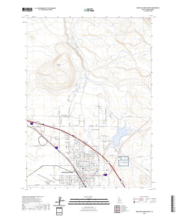
1956 Mountain Home North
Elmore County, ID
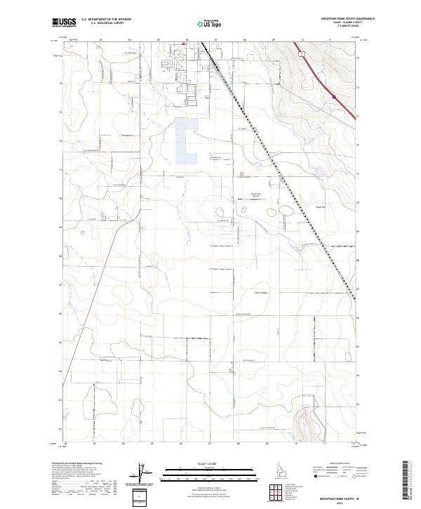
1956 Mountain Home South
Elmore County, ID
1956 Reverse
Elmore County, ID
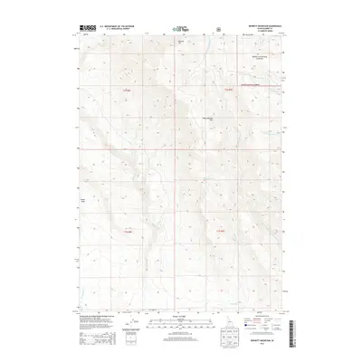
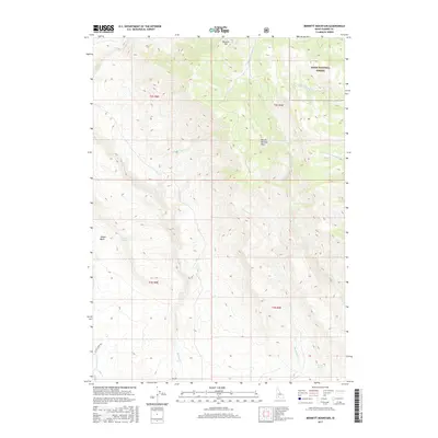
1958 Bennett Mtn
Elmore County, ID
1958 King Hill
Elmore County, ID
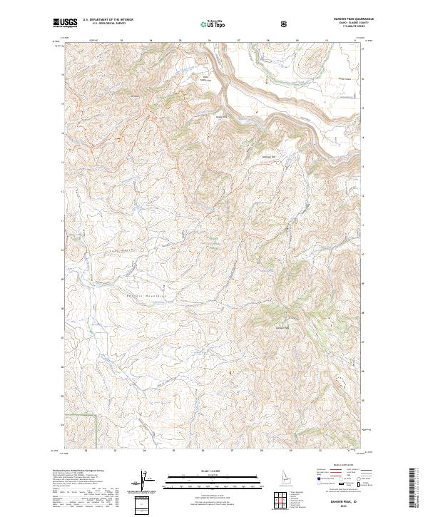
1960 Danskin Peak
Elmore County, ID
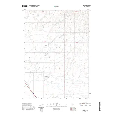
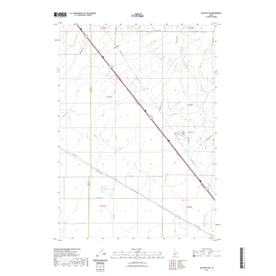
1960 Mayfield
Elmore County, ID
1963 High Prairie
Elmore County, ID
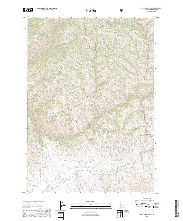
1963 Sprout Mtn
Elmore County, ID
1964 Cayuse Point
Elmore County, ID
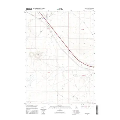
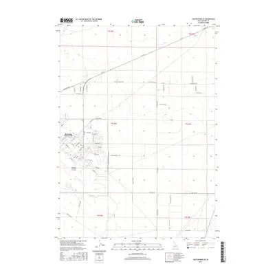
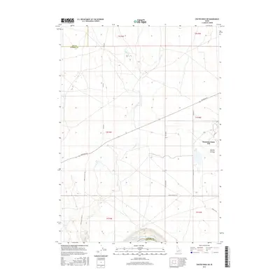
1964 Featherville
Elmore County, ID
1964 Grouse Butte
Elmore County, ID
1964 Jumbo Mtn
Elmore County, ID
1964 Little Trinity Lake
Elmore County, ID
1964 Long Gulch
Elmore County, ID
1964 Prairie
Elmore County, ID
1964 Rocky Bar
Elmore County, ID
1964 Ross Peak
Elmore County, ID

1964 Sheep Creek
Elmore County, ID
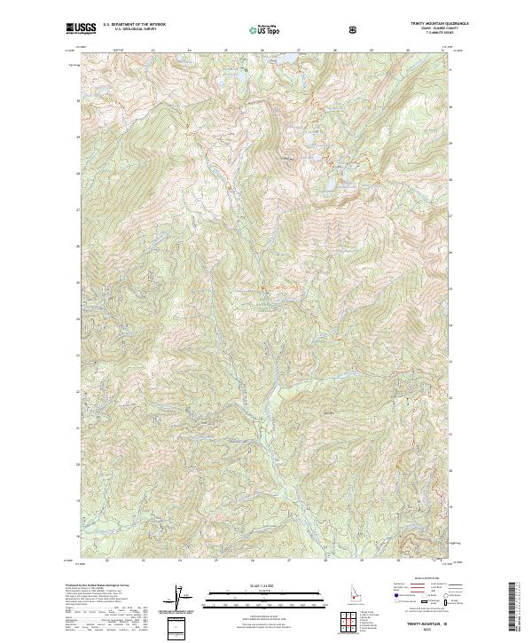
1964 Trinity Mtn
Elmore County, ID
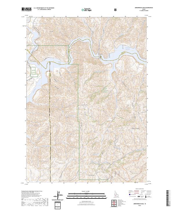
1969 Arrowrock Dam
Elmore County, ID
1969 Grape Mtn
Elmore County, ID
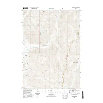
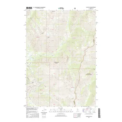
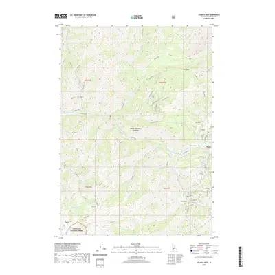
1972 Atlanta East
Elmore County, ID
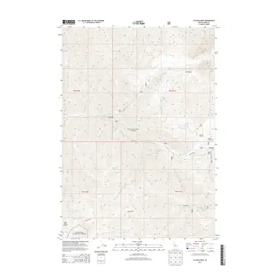
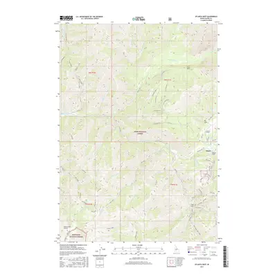
1972 Atlanta West
Elmore County, ID
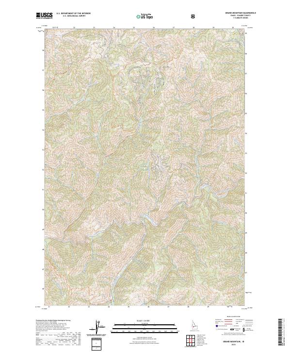
1972 Grand Mountain
Elmore County, ID
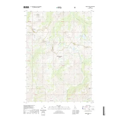
1972 Mount Everly
Elmore County, ID
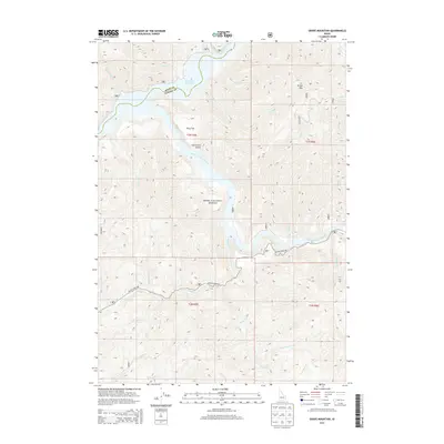
1972 Nahneke Mtn
Elmore County, ID
1972 Phifer Creek
Elmore County, ID
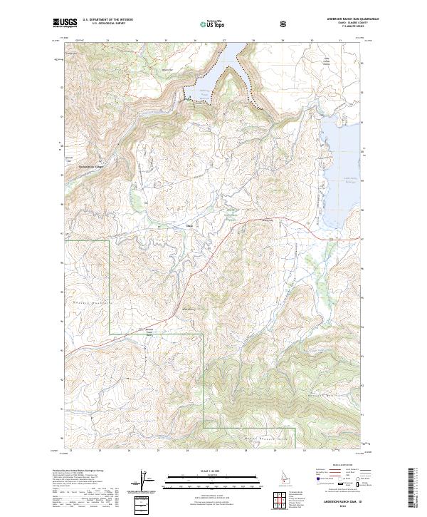
1973 Anderson Ranch Dam
Elmore County, ID
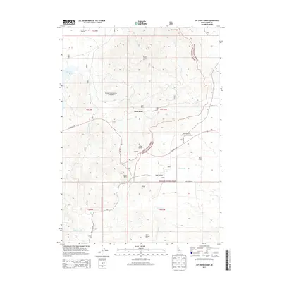
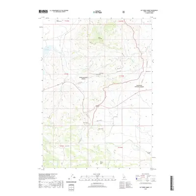
1973 Cat Creek Summit
Elmore County, ID
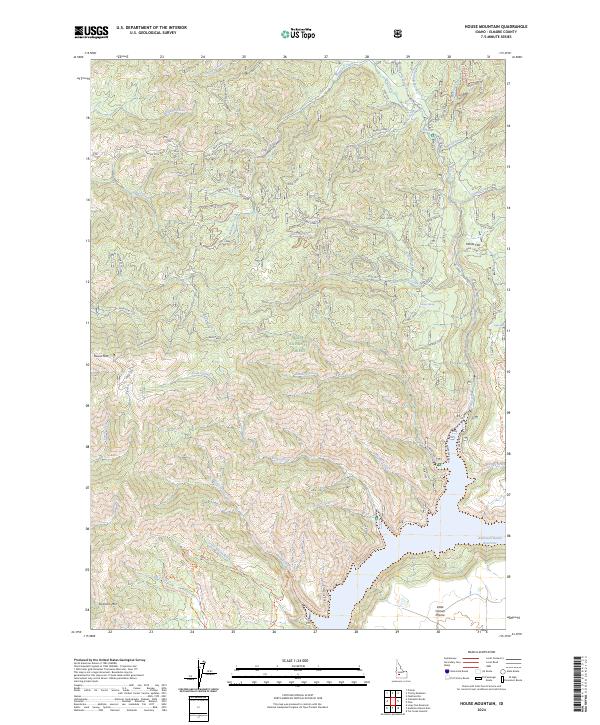
1973 House Mountain
Elmore County, ID
1973 Pine
Elmore County, ID
1986 Bennett Mountain
Elmore County, ID
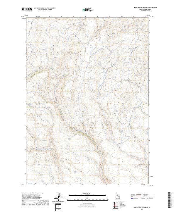
1986 Deer Heaven Mountain
Elmore County, ID
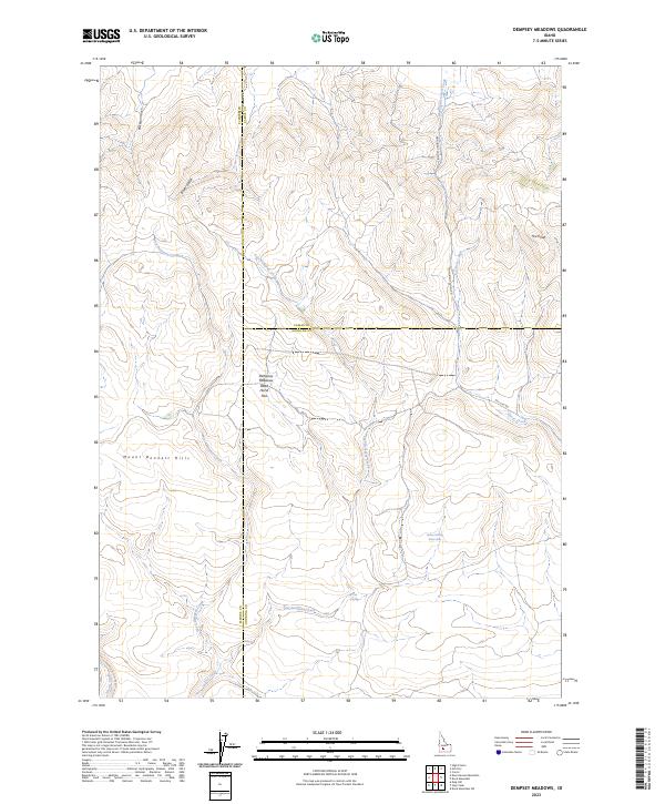
1986 Dempsey Meadows
Elmore County, ID
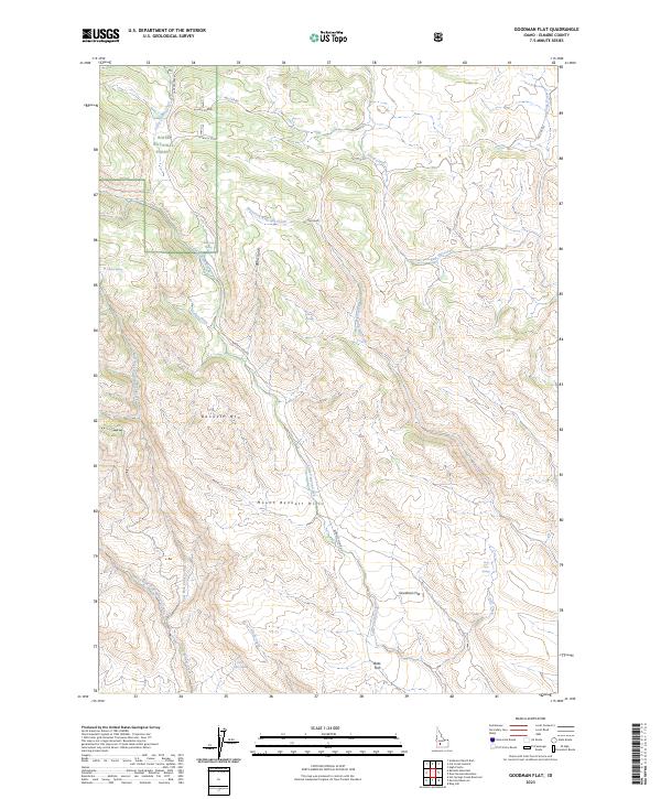
1986 Goodman Flat
Elmore County, ID
1986 Hot Springs Creek Res
Elmore County, ID
1986 King Hill
Elmore County, ID
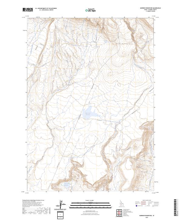
1986 Morrow Reservoir
Elmore County, ID
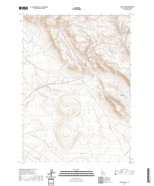
1986 Teapot Dome
Elmore County, ID
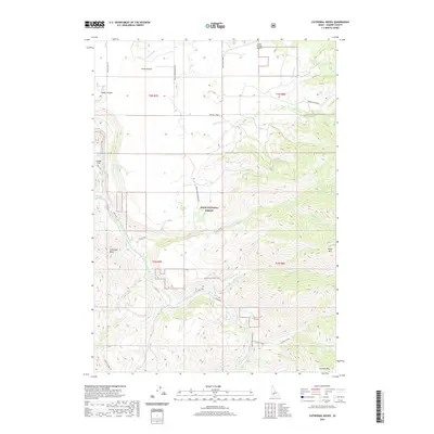
1990 Cathedral Rocks
Elmore County, ID
1990 Danskin Peak
Elmore County, ID
1990 Long Tom Reservoir
Elmore County, ID
1990 Mayfield
Elmore County, ID
1990 Mayfield SE
Elmore County, ID
1990 Mayfield SW
Elmore County, ID
1990 Syrup Creek
Elmore County, ID
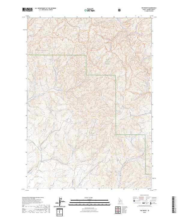
1990 The Roost
Elmore County, ID
1992 Cinder Cone Butte
Elmore County, ID
1992 Crater Rings
Elmore County, ID
1992 Crater Rings SE
Elmore County, ID
1992 Crater Rings SW
Elmore County, ID
1992 Dorsey Butte
Elmore County, ID
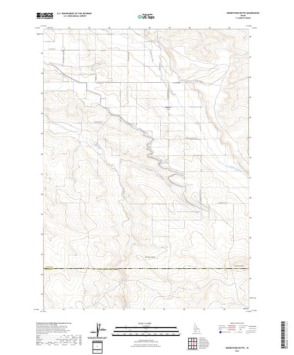
1992 Grindstone Butte
Elmore County, ID
1992 Indian Butte
Elmore County, ID
1992 Mountain Home North
Elmore County, ID
1992 Mountain Home South
Elmore County, ID
1992 Pasadena Valley
Elmore County, ID
1992 Reverse
Elmore County, ID
1992 Ticeska
Elmore County, ID
1992 Twentymile Butte
Elmore County, ID
2010 Cinder Cone Butte
Elmore County, ID
2010 Crater Rings
Elmore County, ID
2010 Crater Rings SE
Elmore County, ID
2010 Crater Rings SW
Elmore County, ID
2010 Deer Heaven Mountain
Elmore County, ID
2010 Dempsey Meadows
Elmore County, ID
2010 Dorsey Butte
Elmore County, ID
2010 Grindstone Butte
Elmore County, ID
2010 Hot Springs Creek Reservoir
Elmore County, ID
2010 Indian Butte
Elmore County, ID
2010 King Hill
Elmore County, ID
2010 Mayfield SE
Elmore County, ID
2010 Mayfield SW
Elmore County, ID
2010 Morrow Reservoir
Elmore County, ID
2010 Mountain Home North
Elmore County, ID
2010 Mountain Home South
Elmore County, ID
2010 Pasadena Valley
Elmore County, ID
2010 Teapot Dome
Elmore County, ID
2010 Ticeska
Elmore County, ID
2010 Twentymile Butte
Elmore County, ID
2011 Anderson Ranch Dam
Elmore County, ID
2011 Arrowrock Dam
Elmore County, ID
2011 Atlanta East
Elmore County, ID
2011 Atlanta West
Elmore County, ID
2011 Bennett Mountain
Elmore County, ID
2011 Cat Creek Summit
Elmore County, ID
2011 Cathedral Rocks
Elmore County, ID
2011 Cayuse Point
Elmore County, ID
2011 Danskin Peak
Elmore County, ID
2011 Featherville
Elmore County, ID
2011 Goodman Flat
Elmore County, ID
2011 Grand Mountain
Elmore County, ID
2011 Grape Mountain
Elmore County, ID
2011 Grouse Butte
Elmore County, ID
2011 High Prairie
Elmore County, ID
2011 House Mountain
Elmore County, ID
2011 Jumbo Mountain
Elmore County, ID
2011 Little Trinity Lake
Elmore County, ID
2011 Long Gulch
Elmore County, ID
2011 Long Tom Reservoir
Elmore County, ID
2011 Mayfield
Elmore County, ID
2011 Mount Everly
Elmore County, ID
2011 Nahneke Mountain
Elmore County, ID
2011 Phifer Creek
Elmore County, ID
2011 Pine
Elmore County, ID
2011 Prairie
Elmore County, ID
2011 Reverse
Elmore County, ID
2011 Rocky Bar
Elmore County, ID
2011 Ross Peak
Elmore County, ID
2011 Sheep Creek
Elmore County, ID
2011 Sprout Mountain
Elmore County, ID
2011 Syrup Creek
Elmore County, ID
2011 The Roost
Elmore County, ID
2011 Trinity Mountain
Elmore County, ID
2013 Anderson Ranch Dam
Elmore County, ID
2013 Arrowrock Dam
Elmore County, ID
2013 Atlanta East
Elmore County, ID
2013 Atlanta West
Elmore County, ID
2013 Bennett Mountain
Elmore County, ID
2013 Cat Creek Summit
Elmore County, ID
2013 Cathedral Rocks
Elmore County, ID
2013 Cayuse Point
Elmore County, ID
2013 Cinder Cone Butte
Elmore County, ID
2013 Crater Rings
Elmore County, ID
2013 Crater Rings SE
Elmore County, ID
2013 Crater Rings SW
Elmore County, ID
2013 Danskin Peak
Elmore County, ID
2013 Deer Heaven Mountain
Elmore County, ID
2013 Dempsey Meadows
Elmore County, ID
2013 Dorsey Butte
Elmore County, ID
2013 Featherville
Elmore County, ID
2013 Goodman Flat
Elmore County, ID
2013 Grand Mountain
Elmore County, ID
2013 Grape Mountain
Elmore County, ID
2013 Grindstone Butte
Elmore County, ID
2013 Grouse Butte
Elmore County, ID
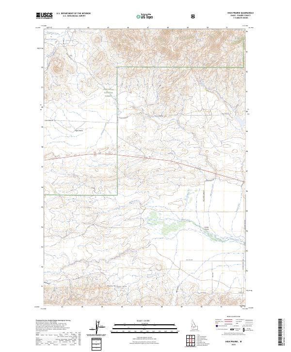
2013 High Prairie
Elmore County, ID
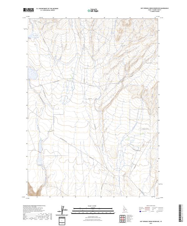
2013 Hot Springs Creek Reservoir
Elmore County, ID
2013 House Mountain
Elmore County, ID
2013 Indian Butte
Elmore County, ID
2013 Jumbo Mountain
Elmore County, ID
2013 King Hill
Elmore County, ID
2013 Little Trinity Lake
Elmore County, ID
2013 Long Gulch
Elmore County, ID
2013 Long Tom Reservoir
Elmore County, ID
2013 Mayfield
Elmore County, ID
2013 Mayfield SE
Elmore County, ID
2013 Mayfield SW
Elmore County, ID
2013 Morrow Reservoir
Elmore County, ID
2013 Mountain Home North
Elmore County, ID
2013 Mountain Home South
Elmore County, ID
2013 Mount Everly
Elmore County, ID
2013 Nahneke Mountain
Elmore County, ID
2013 Pasadena Valley
Elmore County, ID
2013 Phifer Creek
Elmore County, ID

2013 Pine
Elmore County, ID
2013 Prairie
Elmore County, ID
2013 Reverse
Elmore County, ID
2013 Rocky Bar
Elmore County, ID
2013 Ross Peak
Elmore County, ID
2013 Sheep Creek
Elmore County, ID
2013 Sprout Mountain
Elmore County, ID
2013 Syrup Creek
Elmore County, ID
2013 Teapot Dome
Elmore County, ID
2013 The Roost
Elmore County, ID
2013 Ticeska
Elmore County, ID
2013 Trinity Mountain
Elmore County, ID
2013 Twentymile Butte
Elmore County, ID
2017 Anderson Ranch Dam
Elmore County, ID
2017 Arrowrock Dam
Elmore County, ID
2017 Atlanta East
Elmore County, ID
2017 Atlanta West
Elmore County, ID
2017 Bennett Mountain
Elmore County, ID
2017 Cat Creek Summit
Elmore County, ID
2017 Cathedral Rocks
Elmore County, ID
2017 Cayuse Point
Elmore County, ID
2017 Cinder Cone Butte
Elmore County, ID
2017 Crater Rings
Elmore County, ID
2017 Crater Rings SE
Elmore County, ID
2017 Crater Rings SW
Elmore County, ID
2017 Danskin Peak
Elmore County, ID
2017 Deer Heaven Mountain
Elmore County, ID
2017 Dempsey Meadows
Elmore County, ID
2017 Dorsey Butte
Elmore County, ID
2017 Featherville
Elmore County, ID
2017 Goodman Flat
Elmore County, ID
2017 Grand Mountain
Elmore County, ID
2017 Grape Mountain
Elmore County, ID
2017 Grindstone Butte
Elmore County, ID
2017 Grouse Butte
Elmore County, ID
2017 High Prairie
Elmore County, ID
2017 Hot Springs Creek Reservoir
Elmore County, ID
2017 House Mountain
Elmore County, ID
2017 Indian Butte
Elmore County, ID
2017 Jumbo Mountain
Elmore County, ID
2017 King Hill
Elmore County, ID
2017 Little Trinity Lake
Elmore County, ID
2017 Long Gulch
Elmore County, ID
2017 Long Tom Reservoir
Elmore County, ID
2017 Mayfield
Elmore County, ID
2017 Mayfield SE
Elmore County, ID
2017 Mayfield SW
Elmore County, ID
2017 Morrow Reservoir
Elmore County, ID
2017 Mountain Home North
Elmore County, ID
2017 Mountain Home South
Elmore County, ID
2017 Mount Everly
Elmore County, ID
2017 Nahneke Mountain
Elmore County, ID
2017 Pasadena Valley
Elmore County, ID
2017 Phifer Creek
Elmore County, ID
2017 Pine
Elmore County, ID
2017 Prairie
Elmore County, ID
2017 Reverse
Elmore County, ID
2017 Rocky Bar
Elmore County, ID
2017 Ross Peak
Elmore County, ID
2017 Sheep Creek
Elmore County, ID
2017 Sprout Mountain
Elmore County, ID
2017 Syrup Creek
Elmore County, ID
2017 Teapot Dome
Elmore County, ID
2017 The Roost
Elmore County, ID
2017 Ticeska
Elmore County, ID
2017 Trinity Mountain
Elmore County, ID
2017 Twentymile Butte
Elmore County, ID
2020 Anderson Ranch Dam
Elmore County, ID
2020 Arrowrock Dam
Elmore County, ID
2020 Atlanta East
Elmore County, ID
2020 Atlanta West
Elmore County, ID
2020 Bennett Mountain
Elmore County, ID
2020 Cat Creek Summit
Elmore County, ID
2020 Cathedral Rocks
Elmore County, ID
2020 Cayuse Point
Elmore County, ID
2020 Cinder Cone Butte
Elmore County, ID
2020 Crater Rings
Elmore County, ID
2020 Crater Rings SE
Elmore County, ID
2020 Crater Rings SW
Elmore County, ID
2020 Danskin Peak
Elmore County, ID
2020 Deer Heaven Mountain
Elmore County, ID
2020 Dempsey Meadows
Elmore County, ID
2020 Dorsey Butte
Elmore County, ID
2020 Featherville
Elmore County, ID
2020 Goodman Flat
Elmore County, ID
2020 Grand Mountain
Elmore County, ID
2020 Grape Mountain
Elmore County, ID
2020 Grindstone Butte
Elmore County, ID
2020 Grouse Butte
Elmore County, ID
2020 High Prairie
Elmore County, ID
2020 Hot Springs Creek Reservoir
Elmore County, ID
2020 House Mountain
Elmore County, ID
2020 Indian Butte
Elmore County, ID
2020 Jumbo Mountain
Elmore County, ID
2020 King Hill
Elmore County, ID
2020 Little Trinity Lake
Elmore County, ID
2020 Long Gulch
Elmore County, ID
2020 Long Tom Reservoir
Elmore County, ID
2020 Mayfield
Elmore County, ID
2020 Mayfield SE
Elmore County, ID
2020 Mayfield SW
Elmore County, ID
2020 Morrow Reservoir
Elmore County, ID
2020 Mountain Home North
Elmore County, ID
2020 Mountain Home South
Elmore County, ID
2020 Mount Everly
Elmore County, ID
2020 Nahneke Mountain
Elmore County, ID
2020 Pasadena Valley
Elmore County, ID
2020 Phifer Creek
Elmore County, ID

2020 Pine
Elmore County, ID
2020 Prairie
Elmore County, ID
2020 Reverse
Elmore County, ID
2020 Rocky Bar
Elmore County, ID
2020 Ross Peak
Elmore County, ID
2020 Sheep Creek
Elmore County, ID
2020 Sprout Mountain
Elmore County, ID
2020 Syrup Creek
Elmore County, ID
2020 Teapot Dome
Elmore County, ID
2020 The Roost
Elmore County, ID
2020 Ticeska
Elmore County, ID
2020 Trinity Mountain
Elmore County, ID
2020 Twentymile Butte
Elmore County, ID
2023 Atlanta East
Elmore County, ID
2023 Atlanta West
Elmore County, ID
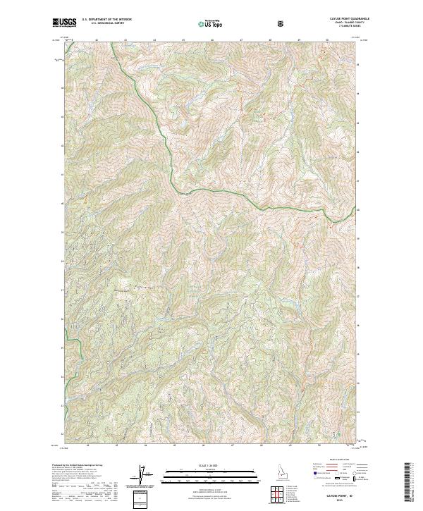
2023 Cayuse Point
Elmore County, ID
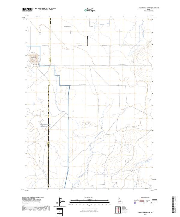
2023 Cinder Cone Butte
Elmore County, ID
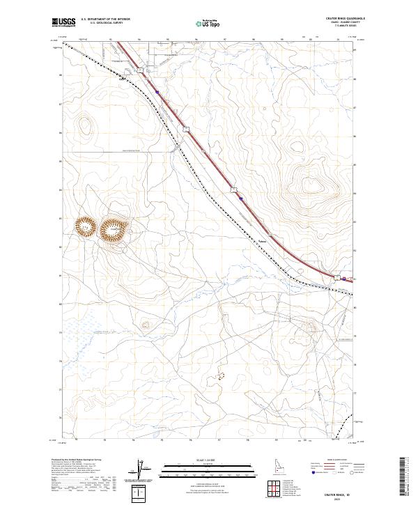
2023 Crater Rings
Elmore County, ID

2023 Crater Rings SE
Elmore County, ID
2023 Crater Rings SW
Elmore County, ID
2023 Danskin Peak
Elmore County, ID
2023 Deer Heaven Mountain
Elmore County, ID
2023 Dempsey Meadows
Elmore County, ID
2023 Goodman Flat
Elmore County, ID
2023 Grand Mountain
Elmore County, ID
2023 Grindstone Butte
Elmore County, ID
2023 High Prairie
Elmore County, ID
2023 Hot Springs Creek Reservoir
Elmore County, ID
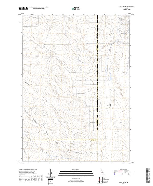
2023 Indian Butte
Elmore County, ID
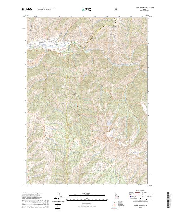
2023 Jumbo Mountain
Elmore County, ID
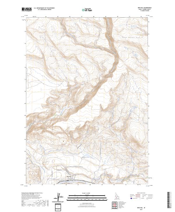
2023 King Hill
Elmore County, ID
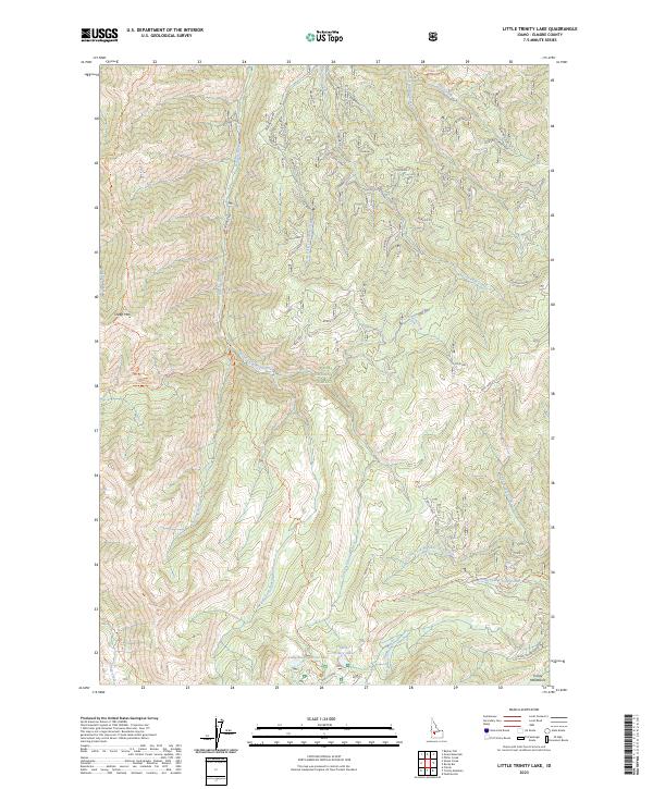
2023 Little Trinity Lake
Elmore County, ID
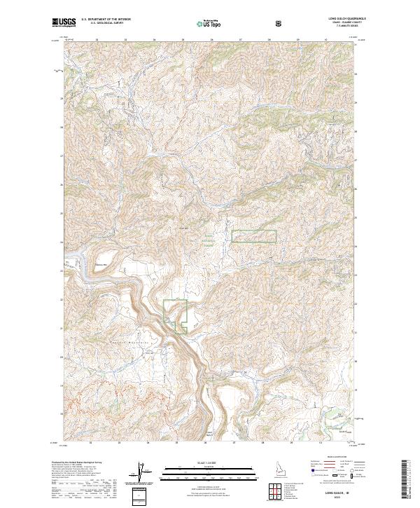
2023 Long Gulch
Elmore County, ID
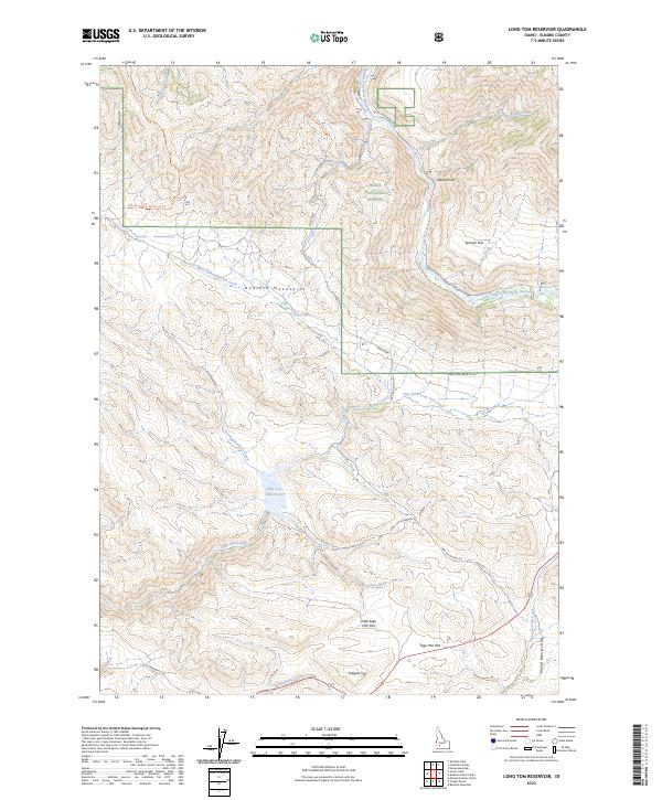
2023 Long Tom Reservoir
Elmore County, ID
2023 Mayfield
Elmore County, ID
2023 Mayfield SE
Elmore County, ID
2023 Mayfield SW
Elmore County, ID
2023 Morrow Reservoir
Elmore County, ID
2023 Mountain Home North
Elmore County, ID
2023 Mountain Home South
Elmore County, ID
2023 Nahneke Mountain
Elmore County, ID
2023 Pasadena Valley
Elmore County, ID
2023 Phifer Creek
Elmore County, ID
2023 Prairie
Elmore County, ID
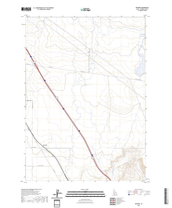
2023 Reverse
Elmore County, ID
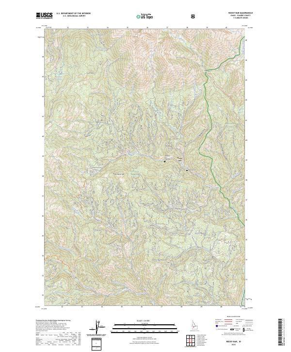
2023 Rocky Bar
Elmore County, ID
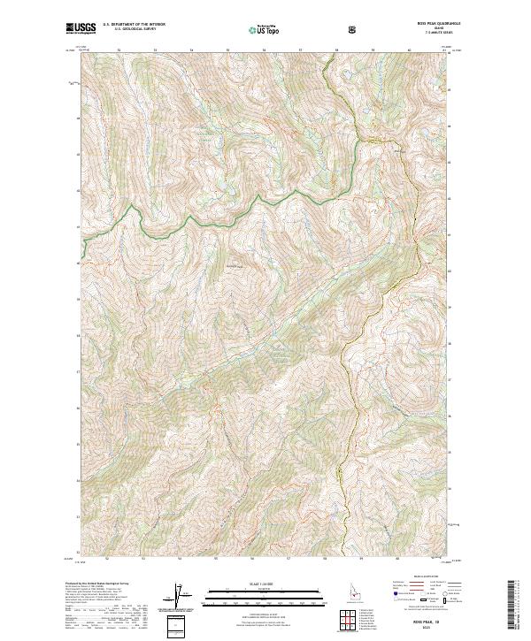
2023 Ross Peak
Elmore County, ID
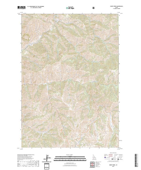
2023 Sheep Creek
Elmore County, ID
2023 Sprout Mountain
Elmore County, ID
2023 Teapot Dome
Elmore County, ID
2023 The Roost
Elmore County, ID
2023 Ticeska
Elmore County, ID
2023 Trinity Mountain
Elmore County, ID
2023 Twentymile Butte
Elmore County, ID
2024 Anderson Ranch Dam
Elmore County, ID
2024 Arrowrock Dam
Elmore County, ID
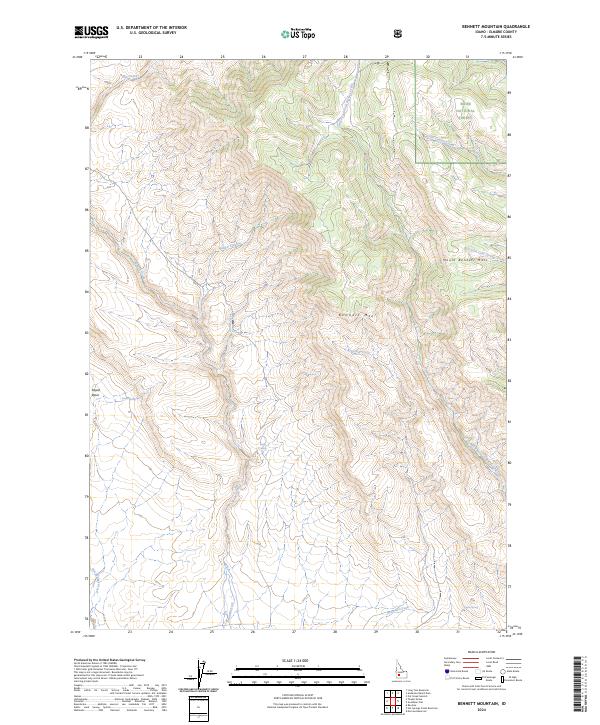
2024 Bennett Mountain
Elmore County, ID
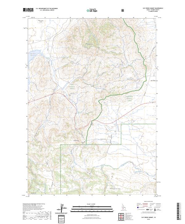
2024 Cat Creek Summit
Elmore County, ID
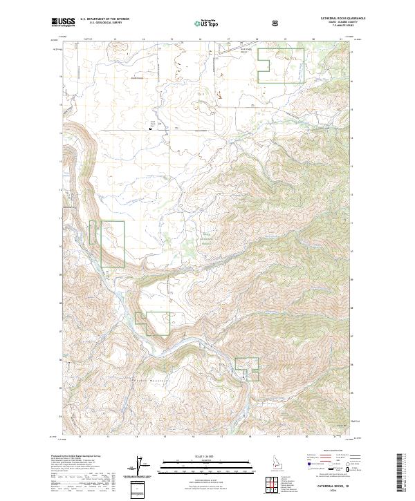
2024 Cathedral Rocks
Elmore County, ID
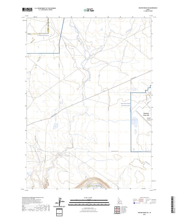
2024 Crater Rings SW
Elmore County, ID
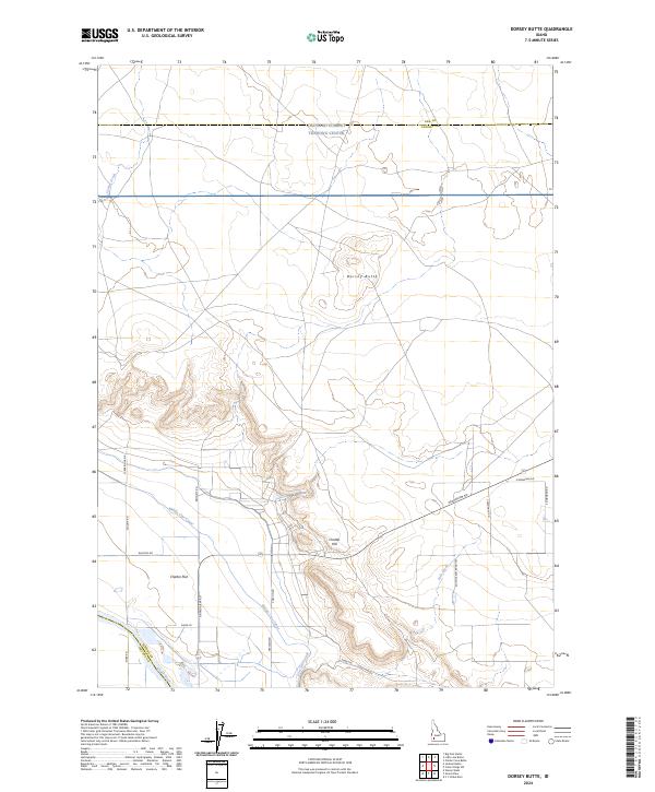
2024 Dorsey Butte
Elmore County, ID
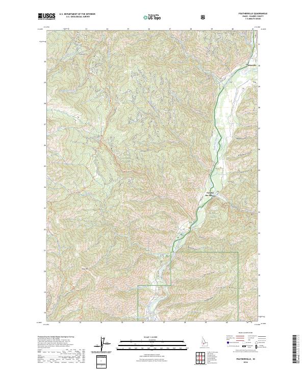
2024 Featherville
Elmore County, ID
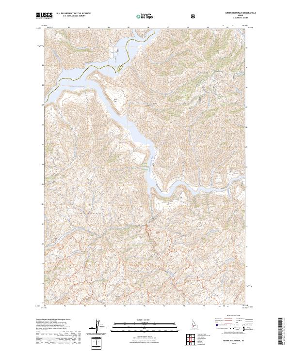
2024 Grape Mountain
Elmore County, ID
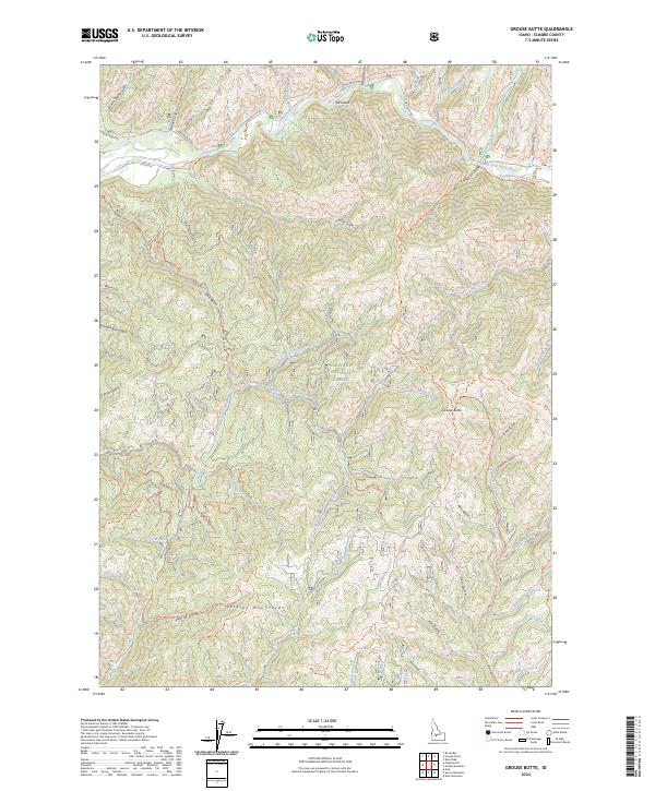
2024 Grouse Butte
Elmore County, ID
2024 House Mountain
Elmore County, ID
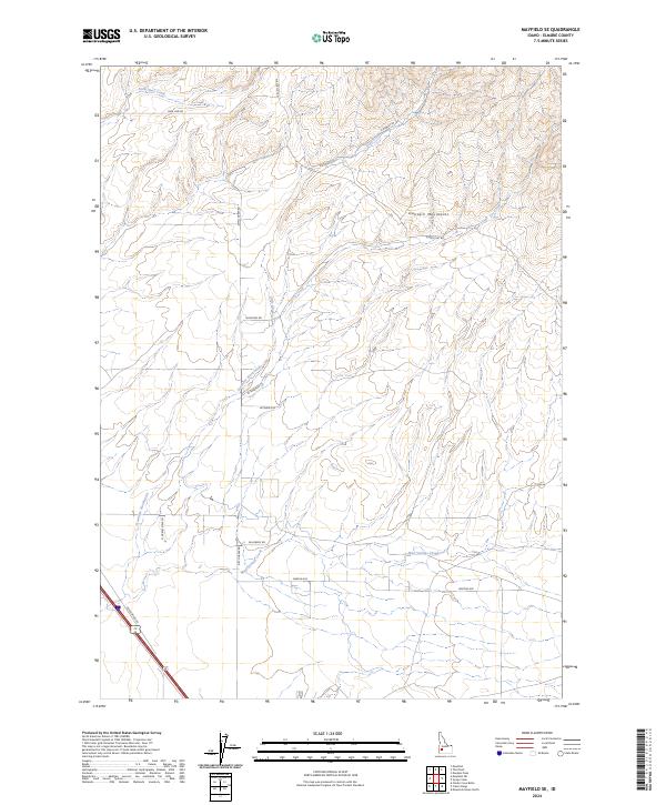
2024 Mayfield SE
Elmore County, ID
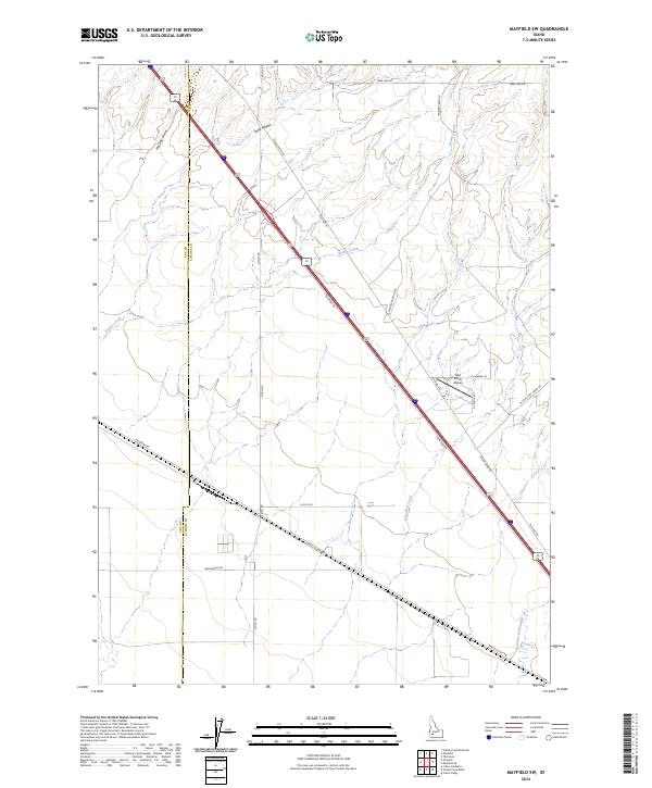
2024 Mayfield SW
Elmore County, ID
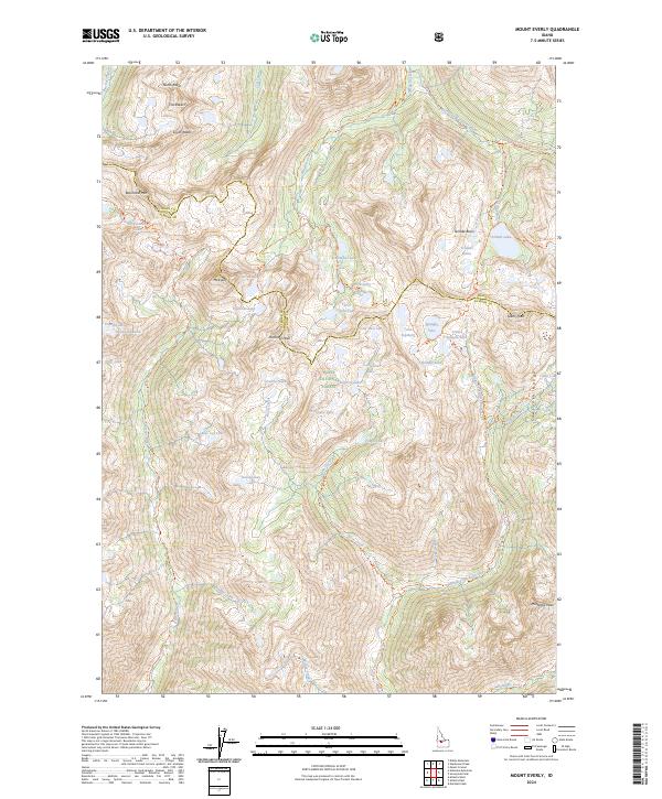
2024 Mount Everly
Elmore County, ID
2024 Pine
Elmore County, ID
2024 Syrup Creek
Elmore County, ID