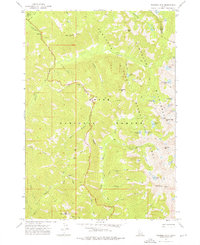
1972 Map of Nahneke Mtn
USGS Topo · Published 1976About this map
The Boise National Forest and Sawtooth National Recreation Area converge in this high-altitude survey of the Elmore and Boise County line. The landscape is defined by its industrial history and glacial hydrology, most notably at the Overlook Mill (Ruins) and a nearby Mine situated between Black Warrior Creek and Mule Creek. These sites reflect the early 20th-century mining activity that once permeated the drainage basins of the Queens River.
Find a feature on this map
47 named features on this map. Tap any name to fly to it.
Don’t see what you’re looking for? This feature index may not catch every label — zoom into the map to look around manually.
Map Details
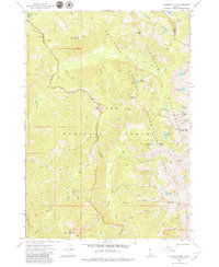
Editions of this 1972 Nahneke Mtn Map
2 editions found
Other maps of this area

1891 · Bear Valley
USGS Topo · 1:125,000

1893 · Bear Valley
USGS Topo · 1:125,000

1894 · Rocky Bar
USGS Topo · 1:125,000

1955 · Hailey
USGS Topo · 1:250,000

1957 · Challis
USGS Topo · 1:250,000

1959 · Hailey
USGS Topo · 1:250,000

1960 · Challis
USGS Topo · 1:250,000

1962 · Hailey
USGS Topo · 1:250,000

1963 · Challis
USGS Topo · 1:250,000
1972 · Atlanta East
USGS Topo · 1:24,000