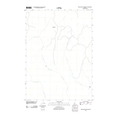
2010 Map of Deer Heaven Mountain
USGS Topo · Published 2010About this map
Deer Heaven Mountain dominates this portion of the Idaho high country, serving as the primary drainage divide for the area's intricate creek network. In this 2010 survey, the landscape is defined by the headwaters of King Hill Creek and Thorn Creek, which carve deep paths through the high-elevation terrain. The map highlights the area's dramatic geography with features like Devils Dive, a distinctive landmark that emphasizes the steep drops typical of this environment. To the south, the West Fork King Hill Creek and Walker Gulch show the natural progression of the watershed as it moves through Elmore County. This map documents a largely undeveloped landscape where topographic relief dictates the course of every stream and the placement of few access roads.
Find a feature on this map
7 named features on this map. Tap any name to fly to it.
Don’t see what you’re looking for? This feature index may not catch every label — zoom into the map to look around manually.
Map Details
Editions of this 2010 Deer Heaven Mountain Map
This is the sole edition of this map. No revisions or reprints were ever made.
Other maps of this area

1892 · Camas Prairie
USGS Topo · 1:125,000

1893 · Camas Prairie
USGS Topo · 1:125,000

1955 · Hailey
USGS Topo · 1:250,000
1958 · Bennett Mtn
USGS Topo · 1:62,500

1958 · King Hill
USGS Topo · 1:62,500

1959 · Hailey
USGS Topo · 1:250,000

1962 · Hailey
USGS Topo · 1:250,000

1963 · High Prairie
USGS Topo · 1:24,000

1963 · Hill City
USGS Topo · 1:24,000
1973 · Cat Creek Summit
USGS Topo · 1:24,000