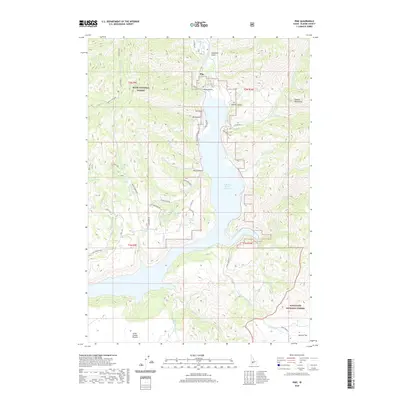
2020 Map of Pine
USGS Topo · Published 2020About this map
Pine serves as a central point of interest in this Elmore County landscape, where the South Fork Boise River feeds into the expansive Anderson Ranch Reservoir. The settlement is supported by local infrastructure including the Pine Airport and Pine Airstrip, alongside a network of mountain roads such as Prairie Pine Road and Lake Creek Road. This 2020 map documents a region defined by its diverse water sources, from the high Soldier Mountains to the numerous springs like Lester Creek Springs and Whitson Spring.
Find a feature on this map
61 named features on this map. Tap any name to fly to it.
Don’t see what you’re looking for? This feature index may not catch every label — zoom into the map to look around manually.
Map Details
Editions of this 2020 Pine Map
This is the sole edition of this map. No revisions or reprints were ever made.
Other maps of this area

1892 · Camas Prairie
USGS Topo · 1:125,000

1893 · Camas Prairie
USGS Topo · 1:125,000

1894 · Rocky Bar
USGS Topo · 1:125,000

1955 · Hailey
USGS Topo · 1:250,000

1959 · Hailey
USGS Topo · 1:250,000

1962 · Hailey
USGS Topo · 1:250,000

1963 · High Prairie
USGS Topo · 1:24,000
1963 · Sprout Mtn
USGS Topo · 1:24,000
1964 · Featherville
USGS Topo · 1:24,000
1964 · Trinity Mtn
USGS Topo · 1:24,000