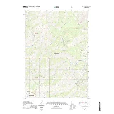
2020 Map of Atlanta West
USGS Topo · Published 2020About this map
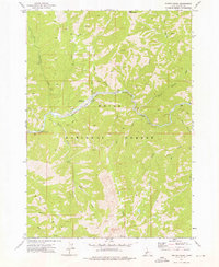
Atlanta and its surrounding wilderness define this high-elevation landscape where the Boise National Forest meets the Sawtooth National Forest. The settlement is situated at the confluence of several steep drainages, including Quartz Gulch and Big Gulch, north of where the Middle Fork Boise River winds through the valley. Access to this remote area is primarily via Atlanta Road, while the Atlanta Airport provides a critical aviation link for the community. The topography is marked by a complex network of canyons and gulches, such as Camp Gulch and China Basin, which have historically driven the development of local transport routes like China Basin Spur B and Yuba River Spur A. For researchers, the map details the rugged ascent toward James Creek Summit and the numerous named tributaries of the Yuba River and Queens River.
Find a feature on this map
69 named features on this map. Tap any name to fly to it.
Don’t see what you’re looking for? This feature index may not catch every label — zoom into the map to look around manually.
Map Details
Editions of this 2020 Atlanta West Map
This is the sole edition of this map. No revisions or reprints were ever made.
Other maps of this area

1894 · Rocky Bar
USGS Topo · 1:125,000

1955 · Hailey
USGS Topo · 1:250,000

1959 · Hailey
USGS Topo · 1:250,000

1962 · Hailey
USGS Topo · 1:250,000

1964 · Ross Peak
USGS Topo · 1:24,000

1964 · Cayuse Point
USGS Topo · 1:24,000
1964 · Rocky Bar
USGS Topo · 1:24,000
1972 · Atlanta East
USGS Topo · 1:24,000
1972 · Swanholm Peak
USGS Topo · 1:24,000
1972 · Phifer Creek
USGS Topo · 1:24,000