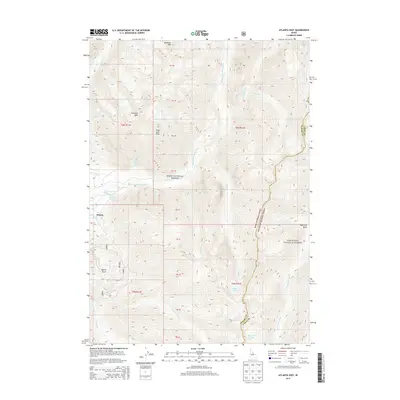
2013 Map of Atlanta East
USGS Topo · Published 2013About this map
Atlanta sits at the western edge of this mountain landscape, marking a historic mining and thermal gateway where the Middle Fork Boise River meets several vital drainages. The area is defined by the high-elevation transition between the Boise National Forest and the Sawtooth National Forest, with the terrain rising sharply toward Blizzard Mtn and Greylock Mtn. Local geology is prominent in the naming of Quartz Gulch, a site tied to the region’s mineral history.
Find a feature on this map
34 named features on this map. Tap any name to fly to it.
Don’t see what you’re looking for? This feature index may not catch every label — zoom into the map to look around manually.
Map Details
Editions of this 2013 Atlanta East Map
This is the sole edition of this map. No revisions or reprints were ever made.
Other maps of this area

1894 · Rocky Bar
USGS Topo · 1:125,000

1900 · Sawtooth
USGS Topo · 1:125,000

1955 · Hailey
USGS Topo · 1:250,000

1959 · Hailey
USGS Topo · 1:250,000

1962 · Hailey
USGS Topo · 1:250,000

1964 · Ross Peak
USGS Topo · 1:24,000

1964 · Cayuse Point
USGS Topo · 1:24,000
1964 · Snowyside Peak
USGS Topo · 1:24,000

1964 · Marshall Peak
USGS Topo · 1:24,000
1970 · Newman Peak
USGS Topo · 1:24,000