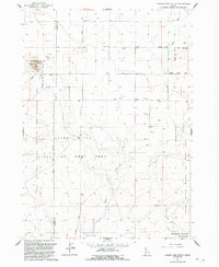
1992 Map of Cinder Cone Butte
USGS Topo · Published 1992About this map
Cinder Cone Butte rises as a prominent volcanic landmark amidst a landscape shaped by military and conservation boundaries. This high desert terrain is largely defined by the sprawling Snake River Birds of Prey Area, established to protect the densest population of nesting raptors in North America. The map reveals how the land is shared between natural preservation and defense needs, with the Idaho National Guard Maneuver and Training Area occupying the western portions and the Mountain Home Air Force Base Small Arms Range situated to the southeast. Industrial and transportation signatures appear through the presence of a Cinder Pit and the utility of Simco Road. Ephemeral drainage patterns are traced by Squaw Creek and Canyon Creek, which carve through the plains near the border of Ada and Elmore Counties.
Find a feature on this map
14 named features on this map. Tap any name to fly to it.
Don’t see what you’re looking for? This feature index may not catch every label — zoom into the map to look around manually.
Map Details
Editions of this 1992 Cinder Cone Butte Map
This is the sole edition of this map. No revisions or reprints were ever made.
Other maps of this area

1892 · Mountain Home
USGS Topo · 1:125,000

1892 · Bisuka
USGS Topo · 1:125,000

1893 · Mountain Home
USGS Topo · 1:125,000

1894 · Bisuka
USGS Topo · 1:125,000

1947 · Dorsey Butte
USGS Topo · 1:24,000

1948 · Dorsey Butte
USGS Topo · 1:24,000

1948 · Big Foot Butte
USGS Topo · 1:62,500

1948 · Little Joe Butte
USGS Topo · 1:24,000

1949 · Little Joe Butte
USGS Topo · 1:24,000

1955 · Orchard
USGS Topo · 1:24,000